Cannich wildfire causes extensive damage to Corrimony nature reserve
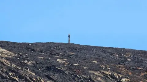
A wildfire that has been burning in the Highlands since Saturday has caused extensive damage to a nature reserve, according to RSPB Scotland.
The charity said many ground-nesting birds, including black grouse, had lost chicks or eggs in the incident near Cannich, south of Inverness.
Hundreds of native trees planted to regenerate habitats at RSPB's Corrimony reserve have also been destroyed.
Smoke from the fire was detected by Nasa satellites earlier this week.
The Scottish Fire and Rescue Service (SFRS) was first called to the blaze just before 13:00 on Sunday.
It was brought under control on Wednesday, but more than 20 firefighters remain at the scene dealing with "deep-seated hotspots".
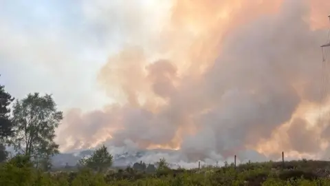 Simon McLaughlin/RSPB Scotland
RSPB Scotland said it had still to fully assess the impact of the blaze on wildlife.
The reserve's Simon McLaughlin said he had found fast-moving species such as spiders and lizards had survived.
But others, including frogs, had been found dead.
RSPB Scotland thanked the dozens of firefighters and estate workers involved in the effort to extinguish the flames.
The charity said: "The damage to Corrimony is extensive, and made even more devastating by the impact on many ground-nesting birds who have lost their chicks and eggs."
Earlier this week, Nasa satellite images showed smoke from the wildfire drifting 12-mile (20km) west towards Loch Ness.
People living near the fire were told to keep doors and windows of their homes closed as precaution against the smoke.
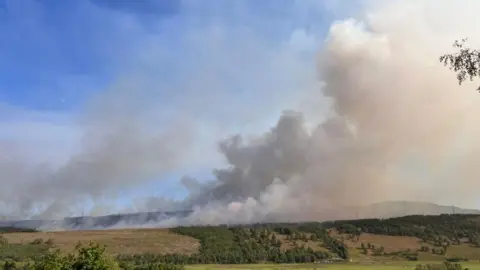 Simon McLaughlin/RSPB Scotland
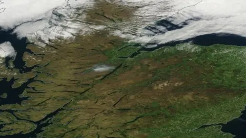 NASA Worldview
Latest available satellite data suggests the area affected could be smaller than previously feared.
SFRS had estimated flames had burned through a 30 sq mile (80 sq km) area of moor and woodland, which would make it the largest wildfire seen in the UK.
The service said it was now estimated to be five square miles (15 sq km) in size.
Wildfire analysts said latest available satellite images suggested the "monumental" firefighting effort had contained the incident.
SFRS group commander Niall MacLennan said: "This has been a challenging large-scale fire, which has no doubt impacted on the rural community here.
"Our crews, who have been working tirelessly since Sunday to tackle this wildfire, will remain at the scene until it's made safe."
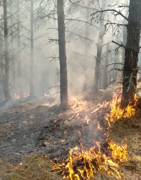 FLS
FLS
At the height of the incident earlier this week, SFRS had nine appliances and their crews at the scene. They were helped by estate workers, including gamekeepers, RSPB staff and waterbombing by helicopters.
Two firefighters were injured during the operation after their all-terrain vehicle overturned. They were flown to hospital and discharged following treatment.
Speaking at the Scottish Parliament, Community Safety Minister Siobhian Brown said wildfires posed a threat to life and the environment.
She said: "I thank all the firefighters and others who are tackling this wildfire.
"The weather and the conditions at this time of year lend themselves to fires starting easily and spreading quickly.
"The smallest fire can spread and devastate entire communities, hillsides, livestock, farmland, wildlife, protected land and sites of special interest."
 Cromarty CRU
In a tweet, wildfire analyst Dr Thomas Smith, an associate professor at London School of Economics, described a "monumental" effort to bring the fire under control.
Analysis of the latest available satellite imagery by Dr Smith and others suggested the damage covered a smaller area than previously thought.
Michael Bruce, of Aberdeenshire-based Firebreak Services Ltd, said a satellite used by the European Forest Fire Information System and EU's Copernicus programme indicated 2,426-acres (982 ha) was involved.
But he added it could amount to 2,718 acres (1,100 ha) because of hotspots outside the main area of the wildfire.
Mr Bruce said: "It was a tremendous successful joint effort by SFRS and local landowners who managed to contain the fire to this size.
"It is always difficult to establish fire size quickly, with smoke and further spread happening, and the focus of the people at the scene is on tackling the fire."
