Man dies after Storm Isha causes major travel disruption
 BBC
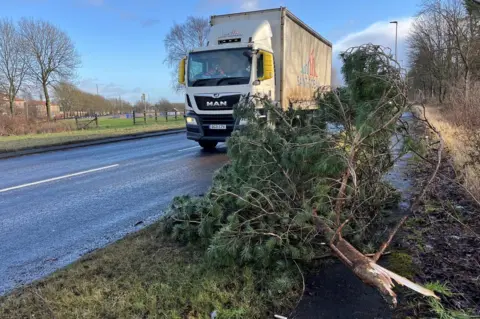
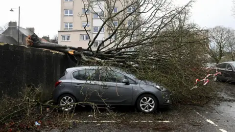
BBCAn 84-year-old man has died after a car he was travelling in hit a fallen tree in central Scotland during Storm Isha.
The front-seat passenger was pronounced dead at the scene of the crash on Beancross Road, Grangemouth, at about 23:45 on Sunday.
More heavy rain and winds are expected on Tuesday as Storm Jocelyn hits, with an amber warning for some areas of Scotland.
Most rail travel stopped on Monday and thousands remain without power.
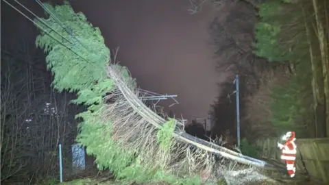
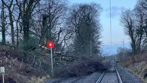
ScotRail suspended all of its train services from 19:00 on Sunday and Network Rail said it was a "challenging" day clearing the tracks.
Lines are gradually reopening and a limited service is operating in some areas.
As of midday, more than 15,000 properties are still without power but engineers have restored connection to about 78,000.
Southern Electricity Networks (SSEN) said it had more than 400 field staff deployed in the north of Scotland network area in response to Storm Isha - about five times the staffing levels on a "business as usual" day.
An amber warning for wind has been issued for Storm Jocelyn from 18:00 on Tuesday until 08:00 on Wednesday morning. It covers the west coast of Scotland and part of the north and north east.
And there is a yellow warning for wind and rain in place from 16:00 on Tuesday to 12:00 on Wednesday.
ScotRail is advising customers that all rail services across the country will be suspended from 19.00 on Tuesday and there will be no rush-hour services on Wednesday morning, as the extreme weather from Storm Jocelyn arrives.
Trains that depart before 19:00 will complete their journey, but no services will begin their journey after that time.
Heavy winds of up to 60/70 mph are expected, which ScotRail said could lead to trees and other debris falling onto the tracks, making conditions unsafe to operate trains.
 Reuters
A rare red danger to life warning was issued by the Met Office for north east Scotland on Sunday night.
Police Scotland warned drivers to take "extra caution" after lowland gusts reached 84mph (135km/h) overnight.
Dozens of flights were disrupted on Monday morning, several ferry services were halted and drivers were warned of dangerous conditions due to high winds and surface water.
Gusts of 84mph were recorded in the village of Salsburgh, North Lanarkshire, 81mph (130 km/h) in Kirkwall on Orkney and 80mph (129km/h) in Wick in the Highlands.
Parts of central and southern Scotland had their highest wind gusts in more than 10 years, with Glasgow and Edinburgh both recording their strongest gusts since 5 December 2013.
Police said conditions for travel may be hazardous and extra caution should be exercised by all road users because of debris on roads, flooding and short-notice closures.
 Adam Blair/ADM Roofing
 Angela Grubb
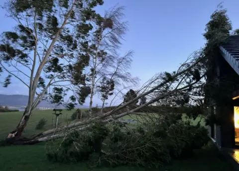
Angela Grubb, from the Black Isle in the Highlands, was woken overnight when a tree crashed into her home.
She said: "The tree fell on the roof, just above my bedroom, on our newly-built extension. I thought 'why didn't it fall on the old part?'
"Our house is very exposed so when a storm hits, my family stays up all night with our fingers crossed.
"I had expected that my greenhouse would blow away, not that this huge old tree would come down.
"There is obviously damage to the roof but it's all fixable."
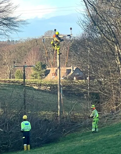

Scottish Power Energy Networks said 55,500 properties in southern and central Scotland had power cuts while a further 30,000 Scottish and Southern Electricity Networks (SSEN) customers lost power.
 Network Rail Scotland
 Network Rail
- The latest winter storm follows a week of disruption caused by snow in north and north-east Scotland.
- Met Office weather warnings - including a red warning for northeast Scotland and an amber warning for high winds across the country - expired earlier.
- A yellow wind warning covered the UK until 12:00.
- The Scottish Environment Protection Agency (Sepa) originally had more than 30 flood warnings in place across the country.
- In the Highland Council area 38 schools were closed, along with more than 60 in Aberdeenshire, almost 20 in Moray and 20 in Dumfries and Galloway.
- All schools in Shetland have been closed since Thursday.
- A number of flight arrival and departures were cancelled on Monday morning at Glasgow, Edinburgh and Aberdeen airports.
David Ross from ScotRail told BBC Radio Scotland's Lunchtime Live programme: "Storm Isha did cause a lot of damage to the network - fallen trees, overhead wire problems, garden objects on the line - for example trampolines.
"There are a number of routes where we're still working to get them back open. There's lots of wok going on across the network by teams at ScotRail and Network Rail to get services back to some sort of normality.
"We are working flat out to get things back up and running. Our advice to passengers planning to travel today is to check the website or the ScotRail app."
He confirmed that repair work was ongoing after a wall and fence blew onto the railway track, affecting Queen Street low level services.
Between Garrowhill and Easterhouse, more than 10 trees fell onto the line.

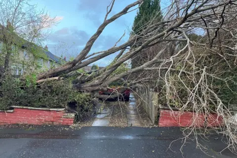
There is also disruption on the roads, with drivers being urged to drive carefully.
Transport Scotland's head of transport resilience, Ashleigh Robson, said: "Surface water will reduce visibility when driving, high-sided vehicles are at risk and the strength of winds could also pose a risk to pedestrians."
Restrictions were in place for double decker or high-sided vehicles for some bridge crossings, including the Dornoch Bridge, Tay Road Bridge, Queensferry Crossing, Erskine Bridge, Kessock Bridge and the Forth Road Bridge.
Many ferry services between the Scottish mainland and the Inner and Outer Hebrides were cancelled as a result of the weather.

Dozens of flights to and from Scotland were diverted on Sunday because of difficulty landing.
They included an Easyjet flight from Edinburgh to Bristol which landed in Paris, leaving passengers travelling without passports unable to stay in a hotel overnight.
Ryanair flights to Edinburgh were diverted to Cologne Bonn airport in Germany, including a flight from Tenerife and another from Seville.
An Easyjet flight from Fuerteventura to Edinburgh landed in Manchester and a TUI flight from Sharm El Sheikh to Glasgow declared an emergency and landed in Manchester.
Other planes were diverted to Edinburgh.
BBC Wales presenter Jennifer Jones was diverted to Edinburgh on a flight from Geneva to Bristol Airport.
"But when we started the descent into Bristol, it was incredibly turbulent and the plane was lurching from side to side," she told BBC Radio Wales Breakfast.
"I've never been in that kind of turbulence."
The Bristol landing was aborted, but landing in Edinburgh was also "pretty hair-raising", she added.


Storm Isha caused widespread disruption in Scotland overnight.
Winds did not turn out to be quite as strong as forecast by the Met Office, which issued a red warning for gusts of up to 100mph in the far north and northeast of the mainland, but they were still very strong.
The highest gust recorded at a low altitude in Scotland was 84mph at the village of Salsburgh next to the M8 in North Lanarkshire, according to the Met Office.
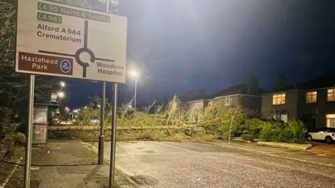
Fallen trees and other debris closed a number of trunk roads including the A1 in East Lothian and the M9 between Grangemouth and Bannockburn.
All passenger and freight services on Scotland's railways have been suspended until later in the day as crews clear debris.
There was widespread disruption to ferries and many planes were diverted.

The Scottish Environment Protection Agency (Sepa) said more flooding was expected across Scotland with 26 flood warnings and 17 alerts still in place.
Speaking on Good Morning Scotland, Sepa duty flood manager Janine Hensman said heavy rainfall over the past two days had combined with significant amounts of snowmelt from last week.
"We had a dramatic temperature increase over the weekend and combined with the rainfall has meant that the rivers have responded quite quickly and there's a lot of water around," he said.
The key affected areas include the Borders and Dumfries and Galloway rivers.
Perth Council was closing the floodgates at Perth but levels were not expected to reach those of the October flood event.
 Fubar News
Ms Hensman warned that peak levels were still expected on the River Tay and the River Spey, with more floods expected in the north of the country.
She urged people to drive with care and to not walk through flood waters.
She added: "Rivers are going to be high all day and possibly into tomorrow as well and we urge everyone to keep an eye on our website which has a threeday public flood forecast and advice on how to prepare."
Isha is the ninth named storm to hit the UK since September.
The Met Office said it was "very rare" for an amber weather warning for wind to cover almost all of the UK.
Clare Nasir, a senior meteorologist at the Met Office said Storm Isha was "incredibly powerful and potent", with the highest gust across the Cairngorms reaching 124mph.
