Norwich Western link road: Pictures released as consultation begins
 Norwich County Council
Proposed changes to a planned bypass link road would reduce its impact on the environment, planners said.
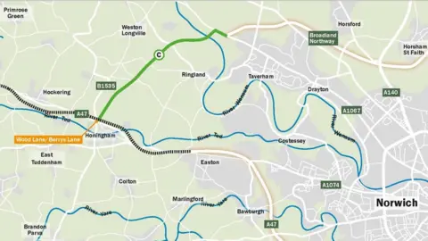
The 3.9-mile (6.2km) Norwich Western Link (NWL) would complete an orbital dual carriageway route around the city.
Norfolk County Council claimed it would reduce congestion and journey times but environmental campaigners said it would harm wildlife and increase emissions.
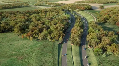
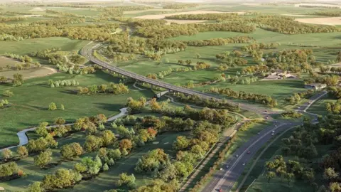
New pictures and plans for better pedestrian access were released at the start of a final public consultation.
The images showed sloped embankments and a transparent "environmental barrier" on the proposed River Wensum viaduct, which the council said would reduce noise and the visual impact.
Planners said another "green bridge" over the NWL for farm traffic, walkers, cyclists and horse riders had been added.
 Norwich County Council
The NWL would connect the A1270 Broadland Northway to the A47, west of Norwich, and could open in 2026.
The council insisted in June it was still value for money despite the building cost rising from £198m to £251m.
Groups who have previously said they supported the project include the Norfolk and Norwich University Hospital, Norfolk Chamber of Commerce, Norwich Airport, Norfolk Fire and Rescue, the New Anglia Local Enterprise Partnership, Road Haulage Association, First Buses, most of the county's MPs and a number of district councils.
But opponents have included Extinction Rebellion, Norfolk Wildlife Trust, the Norfolk Rivers Trust, the Campaign to Protect Rural England, the Green and Labour groups at County Hall and the Stop the Wensum Link group.
The county council said a public consultation would run until 9 October and it hoped to submit a final planning application in 2023.
 Norfolk County Council
Find BBC News: East of England on Facebook, Instagram and Twitter. If you have a story suggestion email [email protected]
