West Country braced for more wet and windy weather
 Met Office
The West Country is set for another spell of very unsettled weather, with the Met Office warning there is a risk of heavy rain and strong winds developing on Friday into Saturday.
Areas of low pressure will approach off the Atlantic to bring a sequence of wet and windier conditions, firstly during Thursday and again later on Friday into Saturday.
The system arriving on Friday has greater potential for causing disruptive weather across southern England.
However, exactly how the storm develops and exactly where it then tracks are currently rather uncertain.
Just small differences in these factors will have a considerable influence upon exactly where winds prove to be strongest, and rainfall the heaviest.
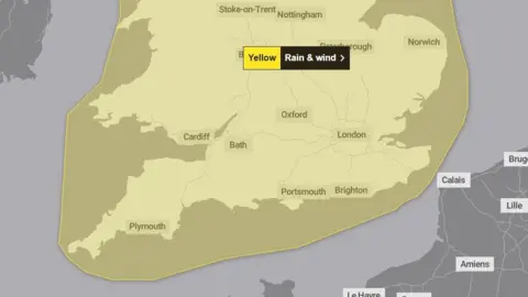
However, forecast confidence is now sufficient that earlier on Wednesday the UK Met Office issued a yellow severe weather warning, currently valid between 15:00 GMT on Friday until 06:00 on Sunday.
For now, the warning covers all of England and Wales but further revisions may be required as forecast detail improves.
If predicted impacts warrant escalating up to an amber warning, the Met Office could decide to name the storm. If so, it would become the fourth named storm of this season.
Risk of severe gales
The current warning suggests wind gusts of 40mph to 50mph inland may become widespread, with some possibly reaching 60mph in places. Exposed coastal areas may experience gusts to 70mph or higher.
Some forecast computer models bring a swathe of strong winds spreading east right across our region, particularly by Friday evening and on into the night.
This is worthy of particular emphasis, because Storm Bert (23-24 November) may have already weakened or damaged some trees and thereby made them particularly vulnerable to further strong winds.
However, the exact final track of the storm may spare the West Country from the worst of the winds. But for now, the message is to 'be prepared'.
Equally, the spread of heaviest rain from this system is open to some uncertainty. But between 15 to 25mm (one inch) of rain may fall widely, with some areas seeing considerably more.
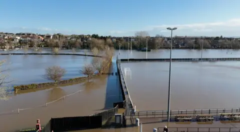
This early December wet spell follows an autumn that proved extremely wet for various parts of our region. Indeed for Gloucestershire, the Met Office says it was the county's wettest on record, in a data set going back to 1836.
A wetter winter?

In the meteorological calendar used to divide each year into neat seasonal 'slices' for the sake of climate statistics, the northern hemisphere winter begins on the first of December and ends on the last day of February.
The incoming wet and windy conditions may set the tone for future periods of this winter.
Seasonal forecasters lean towards it being a wetter than average season overall, with increased chance of windy or even stormy conditions at times, more especially during January and February. However, these types of forecast can only outline broader themes and likely anomalies (departures from climate averages). They cannot foretell specific types of weather likely on any future dates of the winter - despite occasional media headlines claiming the opposite!
Keep across the Met Office warnings, as revisions are always possible to those now issued for Friday into the weekend.
Follow BBC Gloucestershire on Facebook, X and Instagram. Send your story ideas to us on email or via WhatsApp on 0800 313 4630.
