Storm Éowyn to bring wet and windy weather to West
 Rex Features
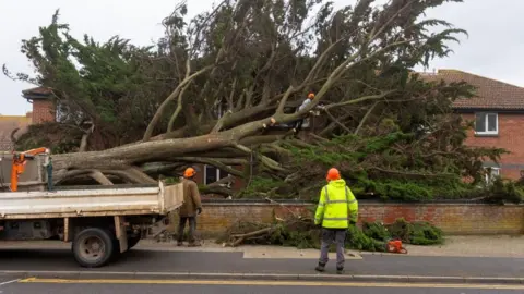
Heavy rain and strong winds are set to sweep aside a recent spell of settled weather in the West Country when Storm Éowyn arrives.
Conditions will start to become more unsettled during Thursday, before a bout of extensive wet and very windy weather begins.
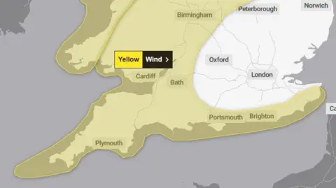
The Met Office has issued a yellow warning for strong winds on Friday and further warnings may become necessary during the coming days.
Forecasts indicate some further periods of very unsettled weather are likely into next week, again bringing a potential for strong winds across the West Country.
 BBC Weather
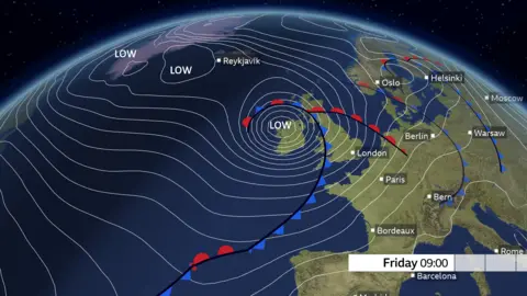
The shift away from recent benign weather to a much more unsettled theme is because the jet stream is about to quickly invigorate.
This high altitude ribbon of fast-moving winds moves broadly west to east across the North Atlantic, marking the boundary between cold air on its northern side and warmer air on its southern side.
It plays a fundamental role in the genesis and development of low pressure systems, and how these are then steered across the Atlantic - often towards the British Isles and north-west Europe.
Recently, the jet stream winds have been weak and have followed a convoluted, meandering path as high pressure has dictated the quieter weather here.
But all that is about to change this week.
The current period of very cold weather in North America will fire-up the jet stream, as the frigid air meets warmth over the Atlantic.
Indeed, the winds high aloft across the ocean may reach over 250mph (400km/h) this week - providing potential for a major tailwind boost to transatlantic jets travelling west to east, but also fuelling increased potential for periods of stormy weather to affect the British Isles.
'Gusts over 60mph'
Prior to Friday's yellow warning for strong winds, a period of moderate to heavy rain will cross eastwards during Thursday, as our weather starts to make a very concerted switch into an unsettled mode.
Soon afterwards, notably windy conditions will become widespread into the early hours of Friday as Storm Éowyn (pronounced "Ay-oh-win") moves close to the north west of the British Isles, where the strongest impacts will be felt.
However, Friday will start on a very windy note here in the West Country where gusts may reach over 50mph (80km/h) inland and over 60mph (97km/h) around the coasts.
 UK Met Office
I expect the strongest gusts in our region are likely to be into the Bristol Channel, across Exmoor and the Mendips, and coastally into Lyme Bay and adjacent inland areas.
The accompanying heavy rain from this storm will probably clear in eastern parts of the region by about late morning, but the blustery conditions will stay for a while longer during Friday. However, the strongest winds will gradually ease through the afternoon.
Please keep across official weather warnings as these may be subject to revisions as we get nearer to Storm Éowyn's arrival.
