Ukraine dam: Satellite images reveal Kakhovka canals drying up
 Reuters
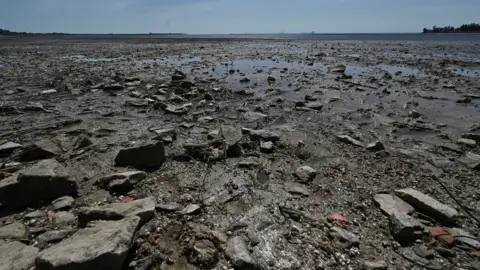
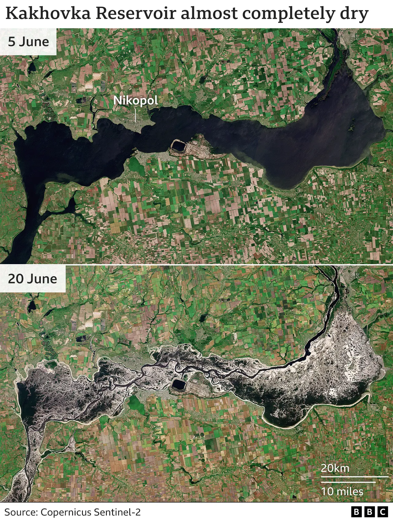
One of Europe's largest reservoirs is drying up after the destruction of the Kakhovka Dam in southern Ukraine.
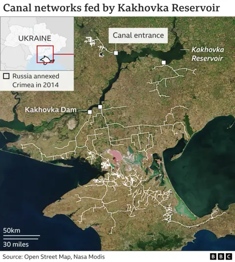
Satellite images, analysed by BBC Verify, show four canal networks have become disconnected from the reservoir.
The UN says drinking water supplies could be affected for more than 700,000 people, mostly in Russian-occupied areas.
Experts say the loss of water from the canals would be critical for food production in the region.
The Kakhovka Dam was destroyed in the early hours of 6 June, causing widespread flooding which hit settlements and farmland across the region.
Since the dam collapsed, satellite images show water levels in both the reservoir and the canals it feeds have continued to drop.
As well as the canals being a source of drinking water to large parts of southern Ukraine, they also provided irrigation for vast areas of farmland. The dam acted as a flood defence to places downstream, mainly to the south and south-west.

BBC Verify monitored the four canal entrances using satellite imagery, and by 15 June, all had become disconnected as the reservoir water level kept dropping.
Further images reveal the reservoir, which previously held 18 cubic kilometres of water, had dried up significantly.

Shallower parts of the reservoir were exposed first, revealing some of the original shape of the Dnipro River prior to the dam's construction in 1956.
Images show the canals still contain water further away from the reservoir. It is unclear how long it will take for them to run dry.
Before the war, about 5,840 sq km (2,255 sq miles) of cropland on both sides of the Dnipro river could potentially be serviced by the canals, with more than half the area reliant on irrigation systems.
These areas yielded about two million tonnes of grain and oil seeds in 2021, according to the Ukrainian government.
Many areas downstream of the reservoir were initially flooded after the dam was destroyed, but the long-term issue facing food production will be the loss of water supply due to extensive canal systems drying up, according to Inbal Becker-Reshef, program director at NASA Harvest, a consortium researching global food security.
"[The canals] primarily irrigate summer planted crops… like corn, soy beans, some sunflower. But they also irrigate some wheat, which is a winter crop, and then a lot of vegetables and fruit like melons," she said.
While some crops can be fed by rain alone, a dry canal system can leave farmland vulnerable to drought. This also has consequences for drinking water.
Dr Becker-Reshef said canals can start to fill in with silt if left dry, reducing their effectiveness, and the longer they are left in this condition, the worse they will become.
Martin Griffiths, Emergency Relief Coordinator for the UN, previously told the BBC there would be a "huge impact on global food security" as a result of the destruction of the dam, describing the area as "a breadbasket not only for Ukraine but also for the world".
Ukraine is a major exporter of sunflower, maize, wheat and barley. The war has caused global supply issues, particularly threatened in Middle Eastern and African countries, which rely heavily on Ukrainian grain.
Is there a solution?
Rebuilding the dam seems to be one of the only long-term solutions to restore water security to the area.
"Now the water level has dropped, the water simply does not reach the [canal] systems. To raise it, we need to rebuild the dam," according to Mykola Solskyi, Ukraine's Minister of Agrarian Policy and Food.
Experts warn the area is at greater risk of both drought and flooding, because the dam helped regulate extreme highs and lows in water levels.
"There's now a whole downstream catchment of the river that is not controlled," said Jaap Flikweert, a flood and coastal management advisor at engineering consultancy Royal HaskoningDHV. "In the wetter periods flood waves will just come through."
Unless the dam is repaired, or extensive flood defences put in place, Mr Flikweert said some areas may prove unsuitable for settlement because they lie so close to river level.
"I expect those tens of thousands of people who were evacuated will have to stay away for a while as long as those solutions are not in place. It is difficult to see people coming back to those communities in this situation."

Read more about BBC Verify: Explaining the 'how' - the launch of BBC Verify

