Why Australia is expecting a long and dangerous summer
 BBC
BBCAlready ravaged by bushfires and drought, Australia is about to enter its hottest season amid forecasts that bring more concern.
The official outlook by the Bureau of Meteorology, released on Thursday, shows the nation's summer is likely to be dry and see above-average heat.
It is expected to fuel conditions which have caused blazes across the nation.
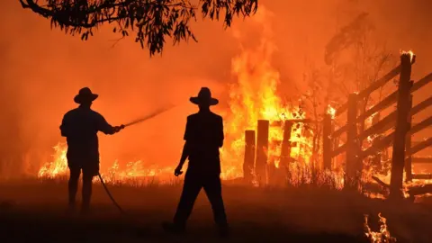
Since September, bushfires have burnt through more than a million hectares in New South Wales (NSW) alone.
What is summer going to look like?
To begin with, it's likely to be much hotter than its normal "average" temperature of 27.5C, the bureau says.
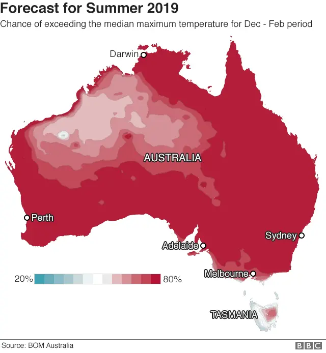
According to forecasts, it is very likely" that summer will see temperatures exceed average levels across the nation.
The dark red parts of the map below show where there's at least an 80% chance of that happening.

How hot will it be?
The bureau hasn't released exact temperature predictions. But the conditions appear similar, officials say, to last summer - the nation's hottest on record.
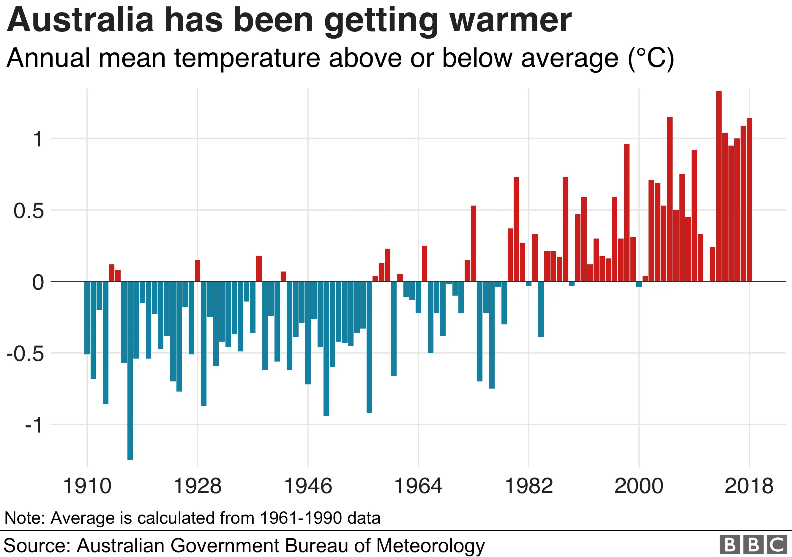
During that summer, the nation averaged 2.14C above the long-term average.
The extreme and prolonged heatwaves of 2018-19 caused blackouts and an increase in hospital admissions.
What about rain?
Drought-stricken areas in Australia's east are predicted to continue to receive "below average" rainfall.
The situation doesn't help towns - particularly in inland Australia - which are already suffering water shortages.
Sydney - the nation's largest city - will also face water restrictions from December after dam supplies dropped to their lowest in a decade.
The nation's current spring season is predicted to be among the five driest on record, the Bom says.
What will this do to bushfires?
Australia is already witnessing an extreme bushfire season, driven by warm and drier conditions. The number of blazes and their severity have alarmed fire crews.
The summer forecast means the "heightened risk" of dangerous fires will continue, the bureau says. This underscores warnings issued by firefighting services in recent weeks.
"We've got the worst of the summer - the worst of the season - still ahead of us," said NSW Rural Fire Service Commissioner Shane Fitzsimmons on 11 November.
What climate patterns are causing this?
The bureau says the "key culprit" is a climate mechanism in the Indian Ocean which has been blamed over floods in Africa as well as Australia's fires.
The positive Indian Ocean Dipole (IOD) occurs when the western part of the ocean becomes significantly warmer than the eastern part. The current event being felt is "one of the strongest" on record, according to chief forecaster Dr Andrew Watkins.
Typically, it is broken up by the entry of a monsoon moving south. But this year's monsoon is running six weeks late, say meteorologists.
What is climate change's influence?
Scientists have warned that climate patterns like IOD could appear more frequently and be more intense as sea surface temperatures increase.
The Bom's State of the Climate 2018 report says climate change has led to an increase in extreme heat events. It has also increased the severity of other natural disasters, such as drought and bushfires.

Official figures show 2018 and 2017 were Australia's third and fourth-hottest years on record respectively.
Reporting by the BBC's Frances Mao
