North Korea nuclear crisis: Test 'caused landslides'
 Planet / 38 North
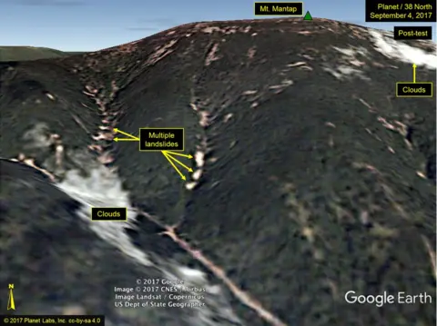
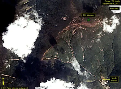
North Korea's recent nuclear test appears to have triggered several landslides, according to what are believed to be the first satellite images of the aftermath.
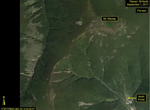
Sunday's test took place underground at the mountainous Punggye-ri site.
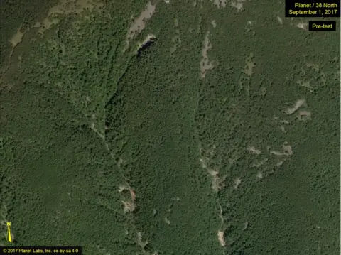
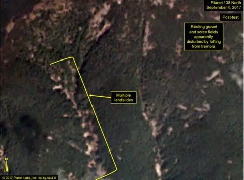
Analysis group 38 North published pictures which show "more numerous and widespread" disturbances than before.
The test unleashed a powerful 6.3-magnitude tremor which was felt across the border in China.
North Korea has conducted six nuclear tests so far, all at Punggye-ri, which consists of a system of tunnels dug beneath a mountainous region.
38 North said its latest pictures, which were taken a day after the latest test, showed landslides as well as numerous areas of gravel and scree fields which were "lofted" from the tremors.
Lofting occurs when shockwaves force material to be lifted up from the ground, and the material falls back down in the same place.
 Planet / 38 North
 Planet / 38 North
The disturbances took place near Mount Mantap, the highest point in the test site.
They were "more numerous and widespread than what we have seen from any of the five tests North Korea previously conducted", the site's analysis said.
But it added that while the test triggered a powerful tremor, it did not appear to have caused the crater to collapse.
Some experts believe however that the nuclear test did cause an underground tunnel at Punggye-ri to collapse.
 Planet / 38 North
 Planet / 38 North
Sunday's bomb was thought to have had a power range from 50 to 120 kilotonnes. A 50kt device would be about three times the size of the US bomb that destroyed Hiroshima in 1945.
The repeated tests have prompted concerns about the test site's longevity, although experts are divided.
Earlier this week Chinese scientists warned of the possibility of the mountain caving in and releasing radiation after future tests, reported the South China Morning Post.
A previous 38 North commentary debunked the possibility of the tests triggering a volcanic eruption.
