Wales weather warning: Thunderstorms set to replace heatwave

 Getty Images
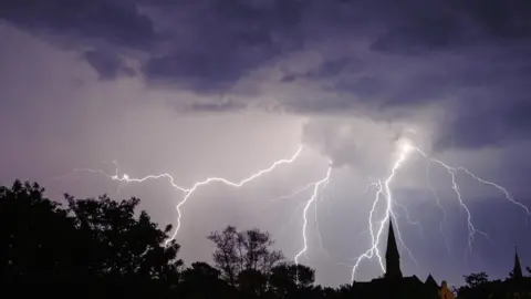
The heatwave is set to come to end this weekend after forecasters issued warnings for rain and thunderstorms covering much of south Wales.
The Met Office said "heavy, thundery showers" are likely, which could be "torrential" with the potential for up to 100mm falling in places.
Lightning and hail are also expected after Wales basked in temperatures of up to 31C this week.
There is a small chance of flooding and power cuts, forecasters warned.
The extreme heat warning, the first issued by the Met Office, was due to end on Thursday night in Wales.
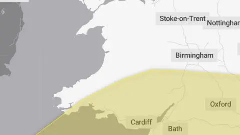
The Met Office updated its forecast on Friday, and has now issued two separate yellow rain warnings.
The first, which come into force at 20:00 BST on Friday and ends at 22:00 on Saturday, covers Blaenau Gwent, Bridgend, Caerphilly, Cardiff, Carmarthenshire, Merthyr Tydfil, Monmouthshire, Neath Port Talbot, Newport, Pembrokeshire, Powys, Rhondda Cynon Taf, Swansea, Torfaen, Vale of Glamorgan.
 Met Office
The second runs from 09:00 until midnight on Sunday and covers Blaenau Gwent, Caerphilly, Cardiff, Monmouthshire, Newport, Rhondda Cynon Taf, Torfaen and Vale of Glamorgan.

- THE ROAD TO TOKYO: Paralympian Tanni Grey-Thompson charts the road to the 2021
- SOCIAL MEDIA & SPORT: Vicki Blight investigates the impact of social media in sport
