Heatwave unveils ancient settlements in Wales

 RCAHMW
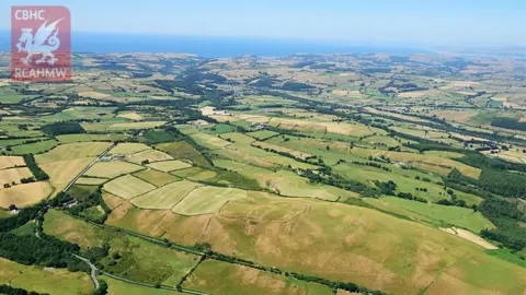
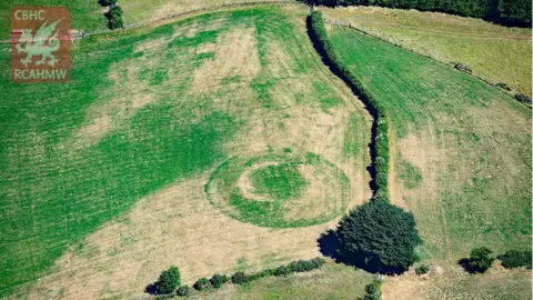
Ancient hillforts and Roman settlements have been revealed by the heatwave.
The dry spell has left parched fields with unmistakable "crop marks" painted into the landscape.
The Royal Commission on the Ancient and Historical Monuments of Wales (RCAHMW) has been busy recording the details - before they disappear when it next rains.
Sites across Wales have been captured from the air.
The crop marks are made by vegetation drawing on better nutrients and water supplies trapped in long-gone fortification ditches - leading to lush green growth that stands out.
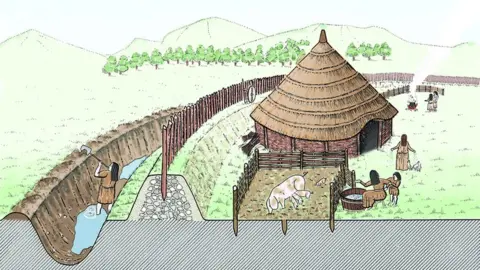
HOW IT WORKS:
 RCAHMW
Most ancient settlements added fortification or drainage ditches around them.
 RCAHMW
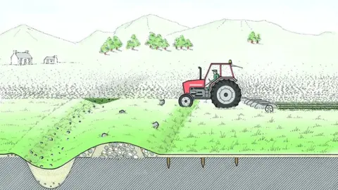
When the settlements disappeared, those ditches became filled in - but it also meant that soil was deeper in those areas.
 RCAHMW
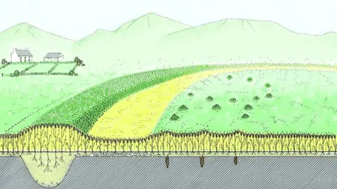
Deeper top soil sections covering the old settlement ditches means those areas hold onto more water and nutrients during intense dry spells - and crops are very quick to take advantage of it - growing thicker, taller, and greener.
It is easy to spot from the air:
 RCAHMW
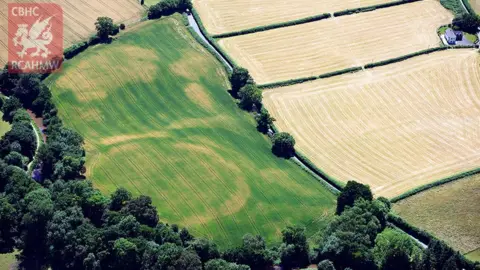 RCAHMW
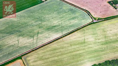 RCAHMW
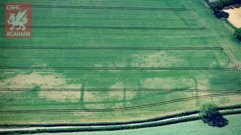 RCAHMW
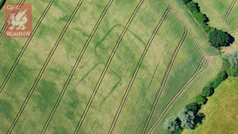 RCAHMW