Hidden underground valleys mapped by experts
 BBC
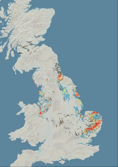
BBCNew mapping has been carried out of hidden underground valleys around Scotland.
The British Geological Survey (BGS) has published data it hopes other geologists will study to help develop their understanding.
They said work now needs to be done to find out what is in the valleys.
They have the potential to be useful for providing geothermal energy or as a groundwater source for the whisky or manufacturing sectors.
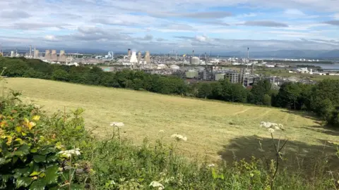
The UK's largest such ancient hidden valley sits under Grangemouth, with others around Glasgow, and Old Aberdeen.
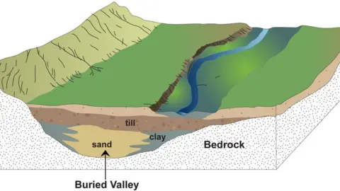
They were formed at the end of the ice age but filled with sediment as sea levels rose.
In most parts of the country the bedrock sits under just a few metres of soil.
But at Grangemouth the deepest deposit is about 162 metres.

Dr Tim Kearsey, project leader at BGS, said: "Britain's buried valleys might be underground, but they could and have had a huge impact on what happens above the surface.
"We combined historical BGS survey activities with over 200,000 borehole records from our national borehole database to identify these previously hidden features across the UK."
Dr Kearsey said the buried valleys were hard to identify from above.
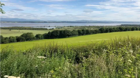
The whole of the Cheshire basin in England looks flat as a pancake but it has lots of features underneath it, he said.
These probably formed under an ice sheet that covered the area some 23,000 years ago.
"The deepest system is in the middle of Scotland, under Grangemouth," Dr Kearsley said.
"It's over 160m deep and absolutely full of clay."


The valleys were formed as the ice sheets retreated at the end of the last ice age about 11,500 years ago.
Their weight reshaped the bedrock below but as sea levels rose they were engulfed with water.
Over time, deposits of clay or sand and gravel filled in the valleys and it is the latter, holding water warmed by the earth, which offers the geothermal energy potential.
Dr Clare Bond, a geologist from the University of Aberdeen, told BBC Scotland: "Scotland has some really good underground resources for a range of energy and heat.
"You've got quite shallow dry aquifers, old mine sources and you've also got the potential for quite deep geothermal which could give you both heat and electric energy.
"What we now need to think about is whether there's water in some of these underground valleys that you could use to pull the heat out by bringing the water to the surface.
"It's really just the start of beginning to map the potential resources and what there could be available."

BGS first identified a hidden valley in the 1870s and has been collecting data since them using thousands of boreholes.
But digital technology has allowed them to collect and collate that data which has been turned into publicly available maps.
With a climate emergency declared by the Scottish government, an increasing emphasis is being placed on developing renewable energy.
Underground water sources could become an limitless source of such energy, particularly for heating homes.
The valley under Grangemouth, which is 'W' shaped, contains solid clay which would be unsuitable for geothermal energy.
But smaller scale valleys are being explored around the River Kelvin in Glasgow and beneath Old Aberdeen.
