Heatwave reveals submerged Mourne history at Spelga Dam
 Ivor Anderson
It is not quite the Lost City of Atlantis but at the gateway to County Down's Mourne mountains a hidden-underwater history has been revealed.
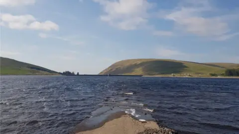
Spelga Reservoir is often full to the brim with water stored to serve parts of counties Down and Armagh.
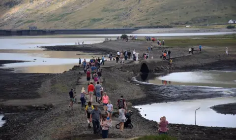
But the recent heatwave and dry weather has caused its supply to drop, exposing what lies on the reservoir bed.
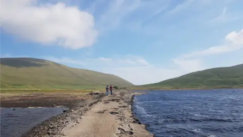
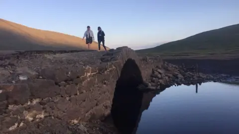
Hundreds of people have been visiting the dam to walk along an old road that usually sits well below the waterline.
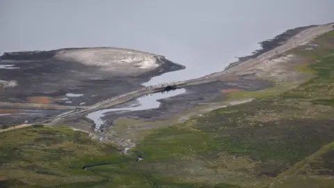
The reservoir covers an area known as Deer's Meadow, which was flooded after Spelga Dam was constructed in the 1950s, creating the 600,000sq m (6.46 million sq ft) basin.
Dividing the meadow was a road that passed between the mountains, connecting Hilltown village on one side of the Mournes with the fishing town of Kilkeel on the other.
 Ivor Anderson
It too was submerged, with a new road built in its place on higher ground around the area of the reservoir - it is the one that is used to this day.
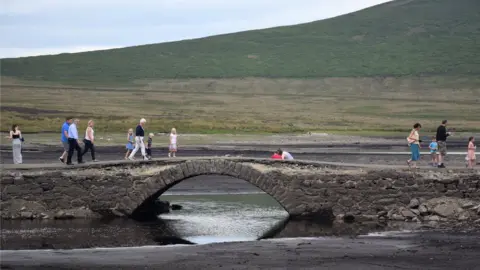
Now standing well above the water's surface is the old, original road that dates back to the early-1800s and features a small bridge that spanned the River Bann, which originates at nearby Slieve Muck.
Dr Arthur Mitchell, a well-known figure in the Mournes, remembers travelling on the old road before the dam was built.
Allow Facebook content?
He worked as a GP in the area for almost 40 years and formed the Mourne Heritage Trust, a conservation group that looks after the mountain range.
"I lived in Downpatrick at the time and I drove over the old road up through Spelga - it was an exceptionally busy road," he said.
"The new road had to be built because the old road ran directly through the valley, so the new road had to detour round the dam and fall away down the valley towards Hilltown."
 Ivor Anderson
Even with the introduction of a hosepipe ban in Northern Ireland at the end of June in a bid to save water, Spelga Reservoir has continued to drain.
While its water level does occasionally dip to a point at which you can see the surface of the old road, it is much less frequent to get a chance to see the bridge - the last time was in 2014.
Now in his 80s, Dr Mitchell has passed along the more recent road around the reservoir many hundreds of times.
Allow X content?
"I have seen Spelga very low before but I don't think it's been so exposed for such a prolonged time as it has been this summer," he said.
"The ground around the bridge is exposed too and the original riverbed - the source of the Bann - is clearly visible at the minute under the original road because the water has fallen so dramatically."
Before Deer's Meadow was flooded it was a prime site for cutting turf for fuelling fires, with farmers from the nearby towns and villages making their way up to it both for work and for play, according to Dr Mitchell.
"Many's a one, when they were cutting turf, ended up with a woman from Hilltown or a woman from Kilkeel - turf cutting was also a social affair."
Dairy cows grazed on the neighbouring and aptly-named Butter Mountain and pigs were farmed on Slieve Muck, which overlooks Spelga.
The tree stumps on the reservoir bed - now exposed as the water has receded - have a wartime tale to tell.
"They are mostly Scots pine and they provided virtually all of the firewood for the Kilkeel and Hilltown areas during the coal strike after World War One," said Dr Mitchell.
And the reservoir's low level is giving new generations an insight in to what were once the ways of life.
"It proves that there was a road through the centre of the Mournes and that those previous social habits and work took place in the mountains - it makes hearsay a reality."
