Yorkshire Three Peaks rail crossing among 'most high risk' on network
 Stephen Armstrong/Geograph
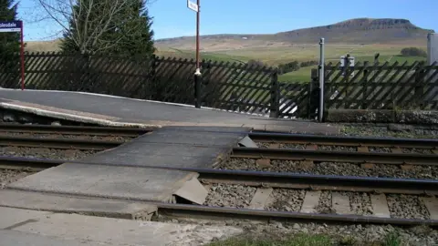
Closing a level crossing used by thousands of walkers is the only way "to reduce risk to an acceptable level", Network Rail has said.
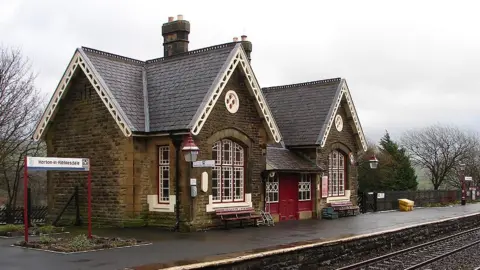
The rail network body has submitted plans to North Yorkshire County Council to replace the crossing at Horton in Ribblesdale Station with a bridge.
The crossing has been assessed as "high-risk", largely due to the volume of hikers and runners using it.
Opponents have called for a full study of the impact on the area's heritage.
'Herd mentality'
In planning papers submitted to the council, Network Rail said there were around 6,000 level crossings across the national railway network, which it had a legal duty to assess, manage and control the risk at.
 John Lucas/Geograph
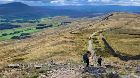
It said Horton in Ribblesdale, which lies on the scenic Settle to Carlisle line, and is used by walkers taking on the Yorkshire Three Peaks Challenge, was one of the most high-risk crossings on the railway network.
"Walkers are often in groups, and sometimes in large numbers taking part in events and challenges, which can mean that people cross one after the other, relying on the person in front to stop, look and listen," the documents said.
"This can lead to herd mentality where a group cross the railway without each individual stopping to make the proper checks."
Network Rail said a bridge with both steps and lifts was the most practicable solution, providing both access for walkers, as well as station users, railway staff and volunteers.
Responding to the plans, the Yorkshire Dales National Park Authority said it had received updated drawings.
A spokesperson said: "Following submission of updated plans for the bridge we are now better placed to support the proposal, subject to a lighting scheme that ensures no light spill into the Dark Sky Reserve and for the bridge to be painted in colours that match those of the railway".
 Other
OtherNetwork Rail said it had taken the park authority's comments into account.
However, it said any impact was "far outweighed by the significant safety benefits".

Follow BBC Yorkshire on Facebook, Twitter and Instagram. Send your story ideas to [email protected]
