Surrey Thames river levels inches away from floods of 2014
 BBC/Adrian Harms
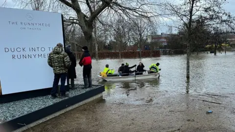
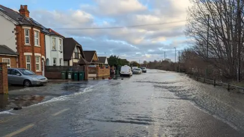
Homes, businesses and roads have flooded in Surrey as the Thames continued to rise, with water inches away from levels seen 10 years ago.
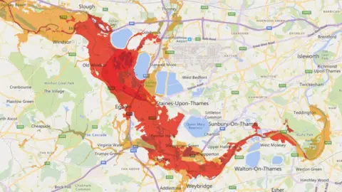
Almost the whole stretch of the river in Surrey is subject to warnings, affecting areas including Chertsey, Walton, Sunbury, Molesey and Egham.
The Environment Agency said floods were on a par with those in 2013 but not expected to reach levels seen in 2014.
One Staines-upon-Thames resident said: "It's a repeat performance of 2014."
Manhole cover danger
Police in Runnymede have advised the easiest way to get to and from Chertsey or Addlestone is now either the M25 or Thorpe Lea Road because all other directions are closed.
Officers posed on Facebook: "Coldharbour Lane is closed due to flooding. The water is coming through the service covers which is incredibly dangerous as it is only a matter of time before they come up from their fixtures.
It has also emerged 32 people were evacuated from Abbeyfields mobile home park in Thameside, Chertsey, in the early hours of Monday.
Surrey Fire and Rescue Service who attended with police said crews arrived to find fast-flowing, deep water flooding homes. Residents were moved to alternative accommodation or a rest centre.
 Ian Swinglehurst
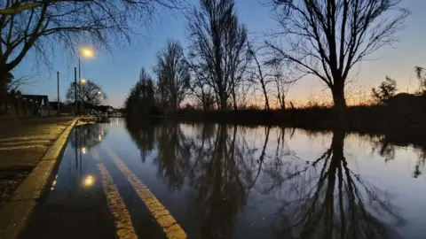
In Staines, Ian Swinglehurst said the river there was about four inches (10cm) away from 2014 levels, with water levels continuing to rise.
The government publishes regularly updated river, sea, groundwater and rainfall levels.
Data on Tuesday showed:
- At Chertsey Lock (downstream), the Thames was 4.5m - 10cm lower than levels recorded on 11 February, 2014
- Penton Hook (downstream) was 4.92m - 12cm lower than levels a decade ago
- Penton Hook (upstream) was 1.37m compared with 1.4m in February 2014
- Chertsey Lock (upstream) showed a 16cm difference
Mr Swinglehurst attributed rising river levels to run-off from fields and hills but also to the Environment Agency's use of the Jubilee River flood relief scheme, which diverts water in Berkshire and returns it to the Thames at Datchet.
Carl Douglas, whose boat-building business at Laleham Reach has flooded, also blamed the Jubilee River, saying floods came in 2003 and 2014 after it came into use in 2002.
An Environment Agency spokesman said: "It is not true that the Jubilee River results in increases in downstream water levels, putting those communities at greater risk.
"After the 2003 flood, further river modelling was completed to re-examine any impacts from the Jubilee River on downstream communities.
"The results showed that there would be very little difference."
Mr Douglas said his workshop had been flooded four times in 20 years and water was now 10 inches deep.
He said when the flooding subsided, he would be left with oil, sewage, water and filth.
 Gov.uk
In Runnymede, the A308 between Egham and Windsor plus the Magna Carta meadow flooded.
Michelle Maxwell-Roberts, who waded through waist-high water on the A308 to drop her children at school, told BBC Radio Surrey: "We've been at our house for 17 years. Luckily, [the water] has never come into the house. We're resilient."
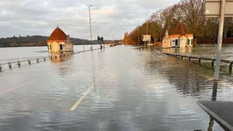
Tom Gray, who also waded through water with his family on the A308, said: "Walking is the only way now. I've known the river for 35 years, and this is the third time we've been through this."
Staff at the flooded 205-room Runnymede Hotel on the river bank were ferried by boat to the site earlier.
In a statement, the hotel said: "The safety and wellbeing of everyone at the hotel is our number one priority and steps have been taken to accommodate guests who've been impacted."
 Hannah Rush
Surrey County Council previously said it was working with the Environment Agency and local councils to deliver the planned River Thames Scheme, with statutory consultation expected in early 2024.
Residents have told the BBC the flood relief scheme has been repeatedly discussed since the 1990s but never implemented.
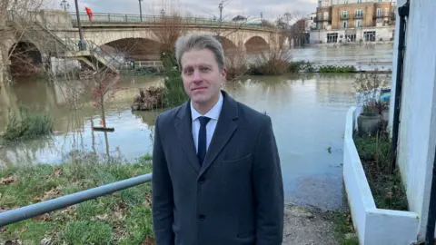
Runnymede and Weybridge MP Ben Spencer said he had been pushing for the scheme to be implemented as soon as possible.
"It is the biggest scheme the Department for Environment Food and Rural Affairs have ever done," he said.
In Chertsey, where the bridge is closed, residents said they were unable to get sandbags.
 BBC/Adrian Harms
Runnymede councillor Sam Jenkins said: "We've made a small number of sandbags available at the council. These are finite in number.
"It is important to emphasise that, because the council strategy at the moment is to protect life over property.
"If the Thames is still rising and you feel that your property is unsafe, my advice is to call the council's emergency line."

Follow BBC South East on Facebook, on X, and on Instagram. Send your story ideas to [email protected].
