Photopost trail installed along banks of Humber estuary at Hessle
 East Riding of Yorkshire Council
A new trail, marked out using so-called 'photoposts', has been installed at Hessle foreshore.
Starting in Cliff Road, on the banks of the Humber estuary, the trail follows the start of the Yorkshire Wolds Way.
The trail forms part of the Active Beacons: Photoposts Project, which aims to boost health while monitoring the East Riding's changing coastline.
People are encouraged to take photographs at each of the wood-turned posts and upload them to social media.
 English Heritage/Heritage Images/Getty Images
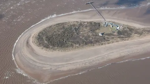
The new posts join 26 existing photoposts dotted along the East Yorkshire coast. They can be found at these locations:
- Sewerby to Bempton
- Hornsea
- Withernsea
- Spurn Point
Nick Coultish, cabinet member for culture, leisure and tourism at East Riding of Yorkshire Council, said the photoposts had become "increasingly popular" among those wishing to explore the county's coastline.

Photopost locations
Using the What3Words app, people can find the latest trail, which is two miles (3.2km) each way, at the following locations:
- Post 1: soaks.layers.free
- Post 2: mingles.beards.cowering
- Post 3: tilt.yummy.verdict
- Post 4: compose.compose.surcharge
Hashtag information can be found at each location, enabling people to easily upload images to social media.
Source: East Riding of Yorkshire Council

Mr Coultish encouraged people to think about "the serious issue of coastal erosion" as they complete the trail.
"Help us monitor this by uploading images to social media," he said.
The project is a joint initiative between the council, tourism agency Visit East Yorkshire, and the University of Hull's Energy & Environment Institute.
The photoposts have been manufactured and designed by Beverley-based Galvin Brothers, with each one displaying an information plaque and QR code to direct users to further information on the project.

Follow BBC East Yorkshire and Lincolnshire on Facebook, X (formerly Twitter), and Instagram. Send your story ideas to [email protected]
