Hampshire and Isle of Wight: Roads flooded in amber rain warning
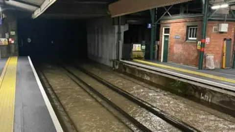
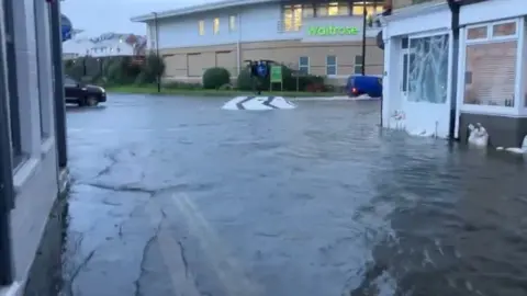
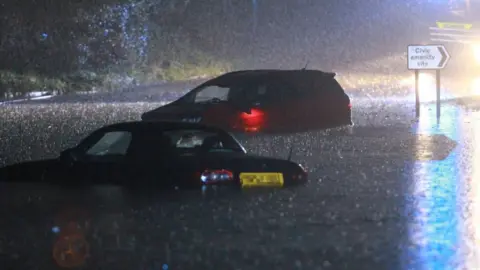
Heavy rainfall has left roads impassable and trains unable to run in parts of Hampshire and the Isle of Wight.
The amber warning, issued by the Met Office, came into effect just after 06:00 BST and was in place until 10:00.
It covered areas around Southampton, Portsmouth and the Isle of Wight.
The island, where four flood warnings are in place, was at the centre of the amber warning with up to 80mm of rain forecast.
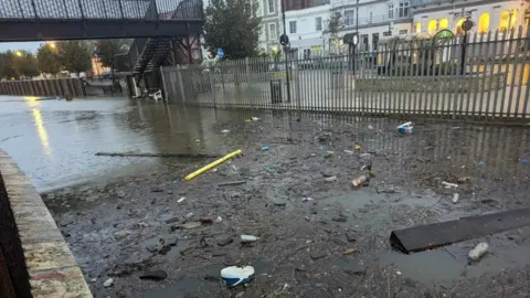
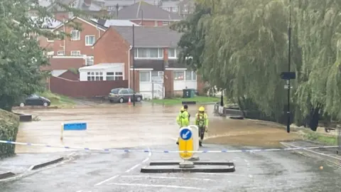
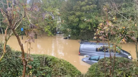
Motorists were left stranded in some of the most severely impacted areas as the rain fell heavily during the morning rush hour.
People were also warned of disruption to public transport.
The Island Line Railway was flooded between Ryde Pier Head and Shanklin, with all lines blocked and trains unable to run.
An Environment Agency (EA) spokesperson said: "River levels are likely to remain elevated over the next few days, along with the weather continuing to be unsettled, so we ask people to keep checking their flood risk.
"We also urge motorists not to drive through flood water which can move vehicles in levels of only 30cm."
 Sarah Tasker
 Island Echo
Karl Love, a councillor based in East Cowes on the island, told the BBC that residents woke up to "devastation in the town".
"This is a flood plain in East Cowes, and the water pumps were not switched on" he said.
"People were carrying all kinds of objects out of their houses - carpets and all sorts of things."
A community centre that is home to mobility charity Mad Aid, also in East Cowes, was among the buildings to be damaged by flooding.
Kate Couch, from the charity, said: "Water was pouring through the front door like a waterfall onto the street
"When I walked in it was over the top of my boots, we think six to eight inches of water in here."
She said the charity had been forced to cancel planned events as a result.
 Cllr Karl Love
The EA warnings cover Ryde, near Monktonmead Brook at St Johns Road, St John's Station and Park Road, as well as Newport for Carisbrooke, Hunny Hill and the Newport Quay Arts Centre on the Lukely Brook.
It also covers the Gurnard area and alongside the Eastern Yar at Whitwell, Wroxall, Horringford, Langbridge and Alverstone.
On Tuesday evening, the Met Office extended its yellow weather warning for Wednesday to more western and north western areas, across parts of south Wales and south-west England.
It also moved it south in the south east, removing most of East Anglia from the warning area.
 Island Echo
At least seven people are now thought to have died in incidents related to Storm Babet across England and Scotland, while hundreds were forced to flee their homes in areas including Chesterfield, Derbyshire.
About 1,250 properties in England flooded during the storm, according to the Environment Agency.
A total of 13 areas broke their daily rainfall records for October last week, including sites in Suffolk, South Yorkshire, Lincolnshire, Wiltshire, North Yorkshire, Nottinghamshire, Northumberland and Derbyshire, the Met Office said.

Have you been affected by the flooding? Get in touch.
- Email [email protected]
- WhatsApp: +44 7756 165803
- Tweet: @BBC_HaveYourSay
- Upload your pictures or video
- Please read our terms & conditions and privacy policy


Follow BBC South on Facebook, X, or Instagram. Send your story ideas to [email protected].
