Lower Thames Crossing proposes farmland to soak up fumes
 National Highways
One of largest road projects in England has proposed using swathes of farmland to soak up pollution.
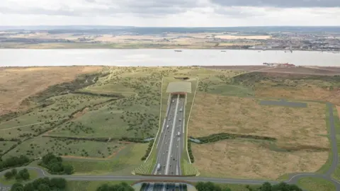
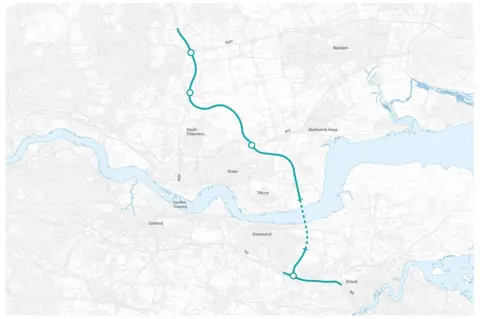
The £8.2bn Lower Thames Crossing will link Kent and Essex with a 14-mile (23km) stretch under the River Thames.
Two parcels of land totalling approximately 111 acres have been identified in Thurrock, Essex, to mitigate nitrogen from exhaust fumes.
Mark Bottomley, from the project, said: "If possible, these areas would be made accessible to the public."
The route, which has been in discussion for more than 10 years, is estimated to open in 2029 or 2030.
Emissions figures, obtained through a Freedom of Information request, found the new route was estimated to create five million tonnes of carbon dioxide (CO2) over a 60-year period.
 National highways
National Highways said land had already been earmarked in Thurrock and Kent which will become wildlife habitats, the Local Democracy Reporting Service said.
But it now need additional land to tackle pollution, located to the south of the A13 in Southfields.
Mr Bottomley, development director for Lower Thames Crossing, said: "As part of our efforts to address the impacts of the Lower Thames Crossing on the environment we're proposing to provide around 617 acres for new wildlife habitats across four sites near to the route of the proposed new road."
Campaigners from the Thames Crossing Action Group said they are still examining lengthy documents published for a new public consultation and will comment once they have done so.
Consultation on the plans end on 20 June.

Find BBC News: East of England on Facebook, Instagram and Twitter. If you have a story suggestion email [email protected]
