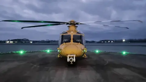
Henstridge: Air ambulance to get low visibility landing system
 DSAA
DSAADorset and Somerset Air Ambulance is to benefit from a new navigation system to enable it to land in low cloud.
Its base at Henstridge Airfield, Dorset, is one of five sites selected for the Global Navigation Satellite System (GNSS) programme.
Currently the helicopter is allowed to fly in poor visibility but not if the cloud is below minimum levels at its landing site.
GNSS will enable it to land even if the site is not visible from the air.
The charity submitted a successful a bid to the Civil Aviation Authority and Department for Transport at the end of September for a share of £200,000 to pay for the technology.
Gloucestershire, Worcestershire, Sussex and London were also successful in bidding for their landing sites at Almondsbury, Strensham, Royal Sussex County Hospital in Brighton and King's College Hospital in Camberwell.
 DSAA
DSAAThe technology uses 3D information from satellites to guide aircraft approaches instead of using ground-based systems.
Dorset and Somerset's AW169 helicopter is already equipped to use GNSS for approaches, and its pilots are licenced to fly them.
The availability of GNSS means the aircraft will no longer be stranded away from base as a result of the weather.
A charity spokesperson said: "We are delighted with the news that Henstridge Airfield is now part of the GNSS programme as it fully supports the charity's commitment to reaching more patients who need critical care."
Rob Bishton of the CAA said: "Emergency services will benefit from improved flight safety and increased resilience for helicopter services, which will allow landings to take place in severe weather and challenging conditions - potentially saving lives in critical situations."

Follow BBC South on Facebook, Twitter, or Instagram. Send your story ideas to south.newsonline@bbc.co.uk.
