Cambridge map reveals 2,000 years of hidden history
 Historic Town's Trust
The hidden history of Cambridge stretching back to the Roman era has been revealed in a newly published map.
It is part of a Europe-wide project to map as many historic towns as possible, many of which have "altered out of all recognition" since World War Two.
Researcher Tony Kirby said recent archaeological reports had been a "major source" for the map.
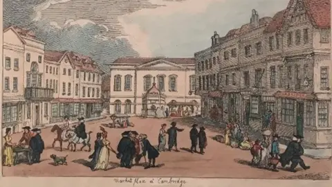
The Historic Towns Trust map explores the city's urban history "contrasting town with gown", he said.
 Metropolitan Museum, New York
"Cambridge is probably the most intensively dug city in the country because of the rate of its redevelopment," said Mr Kirby, a former principal history lecturer at Anglia Ruskin University.
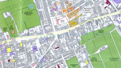
The map uses a 1925 Ordnance Survey of Cambridge as its template, because it is "easier to map buildings which have disappeared using historic property boundaries on older maps".
This means the Abbey area includes the location of the long-gone Barnwell Priory, but not Cambridge United's Abbey Stadium which was built in the 1930s.
Mr Kirby said: "The interesting thing about this area is the mix of residential and commercial buildings which have been swept away in the century since - brewers, bakers, iron foundries - they have all just disappeared in the de-industrialisation of Cambridge."
 Historic Town's Trust
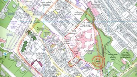
The Castle Hill area shows the site of Roman walls and cemeteries, as well as the former town gaol.
"I knew quite a lot of the history when I started, but I did not know how many schools, both local authority and private there were in Cambridge," he said.
"Nearly all were connected to the Anglican church, with groups of schools connected to St Giles' Church on Castle Hill and another group further east connected to St Matthew's Church."
 Cambridge Antiquarian Society
The map also reveals what is now believed to be the route of the King's Ditch, along Downing Street, down Hobson Street, under Sydney Sussex College to Midsummer Common.
"First built possibly pre-Norman Conquest and remodelled in 1265, it was intended as a defensive work but ended up as an open sewer," Mr Kirby said.
He researched and compiled the map with Elizabeth Baigent, university reader in the history of geography at Oxford University.

Follow East of England news on Facebook, Instagram and X. Got a story? Email [email protected] or WhatsApp 0800 169 1830
