UK weather: Storms and rain bring flash floods to southern England
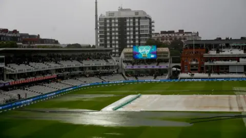
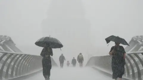
Thunderstorms and flash floods have struck parts of southern England, causing flash flooding in large areas of central London.
Intense downpours began in London and swept the South East on Wednesday.
High Beech, in Essex, saw the highest rainfall with 64mm falling in a 24-hour period, while Frittenden in Kent had 46mm of rain falling in one hour.
Light and patchy rain in localised areas is expected over the next few days.
The Met Office forecasts that Thursday will be damp in Northern Ireland and western Scotland as rain moves eastwards, with cloudy weather across south-east England and brighter spells for Wales and central England in the afternoon.
It follows a day where heavy rain in the capital affected swathes of central London, including Bloomsbury, St Pancras station, Victoria and Kentish Town.
Some shops and platforms at Victoria Station were forced to close after flooding at the main entrance led to large volumes of water running down a slope towards the eastern concourse.
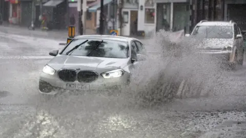
Rain filled the north London high streets of Stoke Newington and Stamford Hill, with cars seen struggling to drive through the water.
The Almeida Theatre in Islington had to cancel a matinee performance as water leaked through the roof.
 Reuters
 PA Media
Heavy rainfall led to roads across England, Wales and Scotland becoming flooded on Tuesday, following weeks of extreme heat and tinder-dry conditions.
Gatwick Airport in Crawley, West Sussex, has warned of delays and cancellations to some flights as air traffic control restrictions were declared across the south due to poor weather.
Worksop in Nottinghamshire experienced 93mm of rainfall between 17:00 and 20:00 BST on Tuesday - almost twice the average monthly rainfall of 54mm, according to BBC weather presenter Simon King.
And more heavy rainfall is expected in England and Wales, with the most intense rain likely to fall in the South East covering London, Kent, West Sussex, Essex and Suffolk.
BBC Weather's Stav Danaos said: "Low pressure pushing in off the Atlantic will bring more of a breeze during Thursday, and this weather front will bring a band of cloud and rain which will slowly spread from west to east across the country.
"So initially we start of with quite a bit of cloud around, one or two heavy showers in the south east, but increasing amounts of sunshine for central, southern and eastern areas into the afternoon."
He added temperatures are set to peak at 25C in the south-east.
 Getty Images
 Getty Images
A total of eight areas of England are officially in drought despite the downpours this week, with Thames Water becoming the latest water provider to announce a hosepipe ban, which will come into force later this month.
Pollution warnings are also in place for dozens of beaches in England and Wales after untreated sewage was discharged into the sea around the coast following the period of heavy rain.
Water companies faced criticism, including after untreated sewage had been released upstream of popular swimming spot Warleigh Weir, along the River Avon.
Southern Water, one of the companies responsible for the affected regions, said storm releases were made to "protect homes, schools and businesses from flooding", adding the release was "95-97% rainwater".

Some areas hit by flooding this week
 Burton Bradstock Parish Council
Heavy downpours are unlikely to ease parched conditions seen across much of the UK, however, because rainwater struggles to permeate dry ground.
The conditions mean water will be more likely to run off the dehydrated surface, leading to flash flooding in some areas.
Additional reporting by Rachel Russell.

- TRANSFER TRAGEDY: What happened on board Emiliano Sala's fateful flight?
- STORIES FROM BEHIND THE COUNTER: Angela Hui on growing up in her parents' Chinese takeaway in a small Welsh town

