More snow and rain is falling in the Arctic

 Getty Images
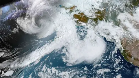
The Arctic is getting wetter.
For a long time scientists could identify no trends in the amount of snow, rain and freezing rain across the region, but that's now changed.
A University of Alaska Fairbanks-led investigation has found statistically significant increases in precipitation on the order of 10% to 15% since 1950.
It's getting wetter everywhere, and in all seasons, with a shift from snow to rain at the fringes of the Arctic where the temperatures are highest.
October 2021 through to September 2022 was the 3rd wettest year of the past 72 years.
The assessment is contained in the 2022 Arctic Report Card, an annual publication from the US National Oceanic and Atmospheric Administration (Noaa).
This is a peer-reviewed document that for the past 17 years has been charting climate impacts in the polar north - one of the fastest warming regions on Earth.
It tracks key Arctic indicators, or "vital signs", and this year sees precipitation added to this list for the first time.
Prof John Walsh from University of Alaska Fairbanks said the sparseness of monitoring stations in the Arctic, especially out over the ocean, had always made it extremely difficult to judge some weather trends. But by taking two independent analytical approaches - using the data that does exist and a global climate model - it was now possible to get a meaningful picture.
"We also looked at trends in heavy precipitation events," he explained.
"As an example, Utqiagvik in northern Alaska had its wettest day on record just this past July.
"Over most parts of the Arctic, there are positive trends in the years' heaviest one-day and five-day precipitation amounts. This is especially true in the sub-Arctic North Atlantic, while the number of consecutive wet days is increasing over much of the central Arctic."
 NOAA
NOAAFreezing rain is becoming a bigger issue. Alaska's second largest city, Fairbanks, recently experienced a 35mm downfall. The problem is the ice layer that's left behind. It makes roads more hazardous and creates difficulties for foraging wildlife until the spring thaw comes.
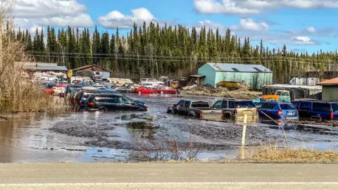
Other complications include the rapid melt of heavier amounts of snowfall, which leads to flooding.
"The infrastructure that's in place, the drainage systems in the villages, in urban areas, is designed for the past," said Prof Walsh. "And as we get new extremes of precipitation then the infrastructure is not going to be able to handle everything that's falling."
Warmer temperatures mean more moisture is evaporating from the ocean, which will eventually precipitate out and show up as snow or rain. But the higher temperatures are also melting the sea-ice cover, exposing more ocean to evaporation, leading to further precipitation.
 ANTHC
ANTHC"The wolf is in the house," commented Noaa Administrator Rick Spinrad.
"By that I mean the climate impacts we're seeing in Alaska: melting permafrost that's warping roads; melting ice that's forcing entire indigenous communities to relocate; warming waters that are forcing fish to migrate, with ripple effects for the entire Alaskan seafood industry; fire seasons that last far longer than they ever have - that's just a snapshot of what parts of the lower 48 (US States) might expect in the very near future."
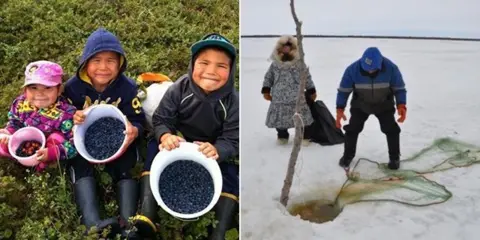
Jackie Qataliña Schaeffer is director of climate initiatives for the Alaska Native Tribal Health Consortium. She said: "Arctic indigenous people interact intimately with our environment. And our safety depends on knowing how to operate on land and sea.
"The distribution, quality, thickness and timing of ice on the ocean, lakes and rivers drive nearly every aspect of life in the Arctic, from boating to whaling, to seal hunting, to the safety of fishing and foraging."
The Arctic Report Card was released at the American Geophysical Union Fall Meeting in Chicago.
