UK also broke its land surface temperature record

 BBC
BBCThe UK not only smashed its weather temperature record this week, it also set a new mark for surface heat.
The 40.3C recorded at Coningsby, in Lincolnshire, was measured, as are all meteorological temperatures, in the shade and 1.5m (5ft) above the ground.
But satellites are routinely mapping the energy retained in the "skin" of the Earth - what someone would feel if they placed their hand on the ground.
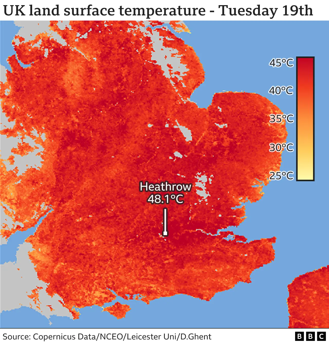
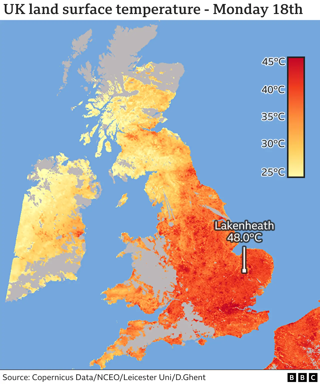
And that rose to 48C on both Monday and Tuesday.
Leading the way on the first day was Lakenheath, with 48.0C - on the second, Heathrow, topping out at 48.1C, with a couple of nearby London boroughs not far behind.
 PA Media
Of course, both these locations have something in common - the wide expanse of asphalt and concrete you associate with an RAF base in the case of the Suffolk town and the big international airport just west of the capital.
Construction materials are very good at absorbing and retaining heat compared with natural land cover.
The previous record, of 44.7C, was set on 25 July 2019, in the Park Royal area of north-west London, which has a lot of those artificial structures expected of business and retail parks.
In the UK, there is a good density of meteorological stations - but in some parts of the world, you might have to travel many hundreds of miles to reach the next properly sited and calibrated scientific thermometer.
And land surface temperature (LST) measurements can be used to infer what the meteorological instruments would record if they were present.
 Satellite Vu
The LST data also reveals something about the heat risk in different environments.
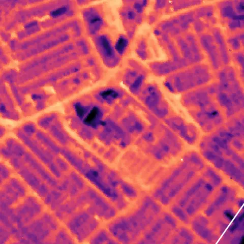
There is much talk currently about the "urban heat-island effect" - the boost in warmth that city and town dwellers suffer because buildings and roads are so efficient at capturing the energy from the Sun.
"And we saw that very clearly on Monday night in the difference between the cities and the rural background," Dr Darren Ghent, a researcher with the National Centre for Earth Observation (NCEO) based at Leicester University, told BBC News.
"In LST terms, the cities were at 25C to 27C, whereas the rural background was only in the high teens.
That's a difference of almost 10 degrees between the city and rural areas.
"That's real evidence of the urban heat island."

It is proof also of the need for more green spaces and trees in built-up areas.
The data above comes from two EU-owned Sentinel-3 satellites that map UK LST every day.
They see the ground at a resolution of 1km; in other words, temperatures are averaged across a km sq box, or pixel.
For a global comparison, the Lut Desert, in Iran, and the Sonoran Desert, in Mexico, have both touched 80C, while the high domes of Antarctica can drop to -110C.
