Plans for up to 540 homes in city unveiled
 Stantec/Bloor Homes
A developer has applied to build up to 540 new homes on the south side of Hereford.
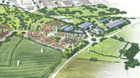
The scheme on mostly farmland between Lower Bullingham Road and Watery Lane would be the first phase of the southern urban expansion to the city, featured in the county's plans.
Bloor Homes Western said in its outline planning application it will aim for 35%, or 189 of the properties, to be affordable.
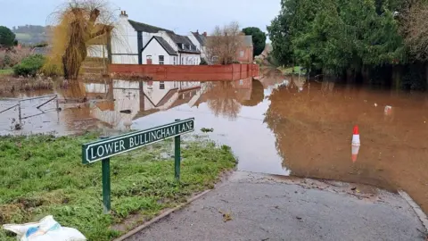
The area is relatively low-lying and repeatedly affected by flooding, leading the developer to include flood mitigation solutions in its application.
Watery Lane is among roads most recently closed following Storm Bert.
Plans for the southern expansion to the city have been set out in Herefordshire Council's main planning document, which is currently being revised.
Bloor's plan would feature about five hectares of employment land to the east, a community hub, shop, country park and other public open space.
Existing industrial buildings would be demolished.
The initial stage of the application is seeking approval on how the plans will fit with the existing road network, which will primarily be via a new roundabout on the Rotherwas Access Road.
 LDRS
LDRSIn respect of the area's flooding, Bloor said it would incorporate “sustainable urban drainage and flood mitigation solutions”, while building “on land predominantly outside of the identified floodplain”.
Measures will also be in place to allow infrequent access by residents, businesses and emergency vehicles when other local routes, known to be affected by flooding, are impassable, it added.
The plans feature water storage ponds “sized to accommodate the predicted future increase in rainfall", to ensure the development does not increase flood risk downstream towards the Wye.
An accompanying flood risk assessment claims to “demonstrate that the proposed development is at an acceptable level of flood risk", if the mitigation strategies are brought it.
Bloor proposes a second phase of the development further west, to include about 400 more homes, a new primary school and park-and-ride facility next to the A49.
This news was gathered by the Local Democracy Reporting Service, which covers councils and other public service organisations.
Follow BBC Hereford & Worcester on BBC Sounds, Facebook, X and Instagram.
