When was the last red wind warning in Scotland?
 PA Media
Storm Éowyn is forecast to be the most destructive storm to hit Scotland's central belt in 13 years.
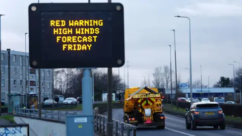
Damaging and dangerous wind gusts are forecast between 10:00 and 17:00 on Friday and the severity of the situation cannot be overstated.
The rare red warning issued by the Met Office is the highest level warning and means the forecasted weather poses a danger to life.
Northern Ireland and Central Scotland are set to bear the brunt of the battering.
An emergency alert was being sent to millions of people in Scotland ahead of the rare red warning.
2012 and the 'sting-jet'
The last wind storm of this scale to affect Central Scotland was on 3 January 2012.
At the time it prompted a Met Office red warning for wind that was similar in scale and scope to the one issued for Éowyn.
That system brought wind gusts of 90mph to Glasgow, with a gust of 102mph recorded at Blackford Hill in Edinburgh.
At the time, it too was deemed to have been the strongest storm to hit central and southern Scotland in 13 years, following the Boxing Day storm of 1998.
The 2012 storm also featured the meteorological phenomenon known as a sting-jet, a mechanism within the atmosphere that develops at a height of about three miles and is associated with rapidly deepening areas of low pressure - or explosive lows - sending a damaging pulse of air to the ground.

Red warnings for wind are unusual. One was issued for the east coast of Scotland ahead of Storm Arwen in 2021, and saw wind speeds of 78mph. It was one of the most damaging storms in modern history, with three fatalities.
Back in 2016, Storm Gertrude saw a red wind warning issued in Shetland. Lerwick and Baltasound recorded wind speeds of 105mph.
What damage can I expect from a red warning storm?
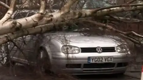
The Met Office said winds could reach 100mph in some areas on Friday and there could be a risk to life due to flying debris, as well as power cuts and damage to buildings.
Back in 2012, it was estimated 100,000 homes and businesses lost power, whilst fallen trees blocked roads and rails.
A swathe of damage to buildings was left in its wake too.
There was massive transport disruption, with the Forth, Tay and Kingston road bridges closed.
Ferry services were delayed whilst flights in and out of Central Belt airports were cancelled.
 Getty Images
Is Storm Éowyn bigger than 'Hurricane Bawbag'?
The January 2012 storm came hot on the heels of another big one in December 2011.
That event prompted the first ever Met Office red warning for wind to be issued, with recorded wind gusts inland of 70 to 80mph fairly widely.
On social media it was famous for viral clips of errant trampolines, with some users dubbing the storm "Hurricane Bawbag".
So Éowyn could certainly see stronger winds than the 2011 event.
 Getty Images
Where did the name Éowyn come from?
Nowadays the Met Office names significant storms itself, in conjunction with Met Éireann in Ireland and their counterparts in the Netherlands.
The idea is to raise public awareness of incoming dangerous and disruptive weather, so that we can be prepared and take action where necessary to stay safe.
Storm Éowyn is the 5th named storm of the 2024/25 season and the first one since the start of the year.
As well as the red warning, there is a significant amber wind warning in place covering the entirety of the country through the day, and a further amber warning in place on Saturday.
