How are sea defences for seaside towns progressing?
 Martin Barber/BBC
Work to bolster a stretch of vulnerable coastline has moved to its second phase after North Norfolk District Council (NNDC) agreed to spend £25m on shoreline protections for the seaside towns of Cromer and Mundesley.
So what is being put in place - and how will the works affect beachgoers?
 Martin Barber/BBC
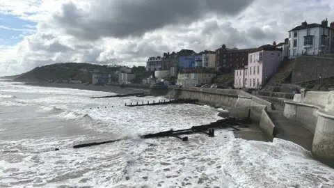
The project is a scheme to ensure two coastal towns fend off the ravages of the North Sea.
The Cromer coastal management scheme includes refurbishments to six timber groynes - wooden structures built perpendicular to the shore - navigation beacons, sea walls, and access improvements.
Work has already started at Cromer's East Promenade, near the Fisherman's Ramp.
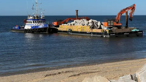
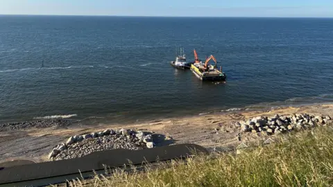
Some 38,000 tonnes of rock armour revetment have been placed on the west side of Cromer Pier along the shoreline.
The application site covers 88 acres (36 ha) - the full Cromer frontage - which is about a mile (1.6km) long.
Work at Mundesley, further south along the coast, got under way in the spring.
It included remedial works to existing groynes and navigation beacons, sea walls and aprons.
A rock berm will be created using 30,000 tonnes of rock placed in front of the existing steel structure along west beach to absorb the energy of the waves.
That application site covers 60 acres (24 ha), about a mile of Mundesley sea front.
Some 600 homes will be protected from coastal erosion and flooding in total, NNDC said.
 Martin Barber/BBC
Who is funding this?
The cost of the entire project is £25m, although it was originally costed at £14.1m.
The increase was blamed on inflation dramatically pushing up prices for materials and labour.
The funding has been met mostly by a government grant from the Environment Agency and NNDC.
Mundesley Parish Council is contributing to the town's project.
Can you still access the beaches?
Rock deliveries are being carried out at high tide by barges through an agreed corridor, and then manoeuvred into place by dumpsters. The barges will then leave on the next high tide.
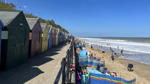
NNDC said that "for health and safety reasons, some localised beach closures will be necessary while the rock is being unloaded".
Signs and traffic marshals will also be on hand to direct members of the public to safe locations to watch the rock delivery.
The primary purpose of rock is to reduce the energy of the waves, which in turn will help keep sediment (sand and shingle) longer.
Beach levels should remain more stable as a result, the council said.
 Andrew Turner/BBC
What sort of disruption can be expected and for how long?
Some temporary, localised beach closures will be necessary while the rock is unloaded, the council said.
Runton Road car park where the work site has been set up, will remain open.
Small work sites will be located on the promenade to help with the work or to store.
The project will be completed at Cromer by winter 2024, said NNDC.
However, the Runton Road car park work site will stay in place until summer 2025 to help with the work at Mundesley.
 Qays Najm/BBC
How many other coastal places in Norfolk are affected by sea erosion?
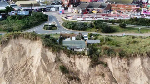
The whole of Norfolk's coastline has been impacted by erosion with additional sea defences called for at many other resorts.
According to Dr John Barlow, senior lecturer in applied geomorphology at the University of Sussex, the East Anglia coastline is particularly vulnerable.
"It's a combination of the poorly consolidated clay, silt and sand material that form the cliffs and the exposure to storm waves coming down the North Sea," he said.
There are lots of Norfolk coastal communities trying to petition for funds for better defences too.
A project costing £2m to repair damaged sea defences along a 10-mile stretch of coastline between Happisburgh and Winterton is set to begin.
But controversially, in Hemsby, where some 20 homes have crumbled into the sea in the past two decades, residents have been told the town does not meet the criteria of government funding formulas to pay for its £20m rock defence scheme.
Follow Norfolk news on Facebook, Instagram and X. Got a story? Email [email protected] or WhatsApp us on 0800 169 1830
