Island landslip site road fully reopens

 Isle of Wight Council
A road near the site of a vast landslip that happened nearly a year ago on the Isle of Wight has fully reopened.
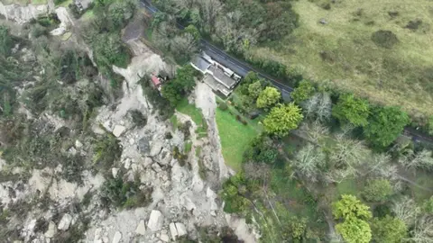
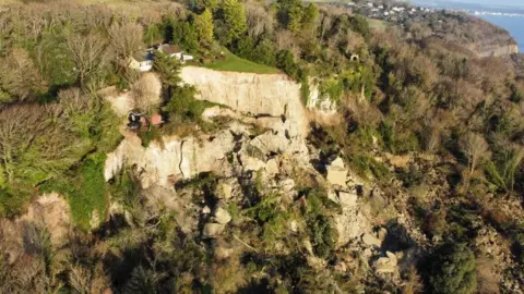
The huge collapse on 10 December saw 16 hectares (40 acres) of land fall away and left several homes teetering on the edge of a cliff.
Residents were forced to leave 20 homes and closed the A3055 Leeson Road between Shanklin and Ventnor.
Devices in boreholes reaching 427ft (130m) into the ground are in place to monitor any further movement.
The equipment will continuously monitor the area and give an early warning of any increase in the risks of a future landslip.
Isle of Wight Council said there will also be weekly site inspections and regular reviews of automated data.
The authority said if the road needed to be closed, details would be published on the council's social media channels as quickly as possible.
One lane of the road reopened for the summer holidays - it fully closed again on 8 September.
During the closure, drivers were diverted from Ventnor, via Wroxall, and from Shanklin, via Whiteley Bank.
 Island Echo
You can follow BBC Hampshire & Isle of Wight on Facebook, X, or Instagram.