City's history explored in new map
 Historic Towns Trust
A map has been published which documents a city's history over hundreds of years.
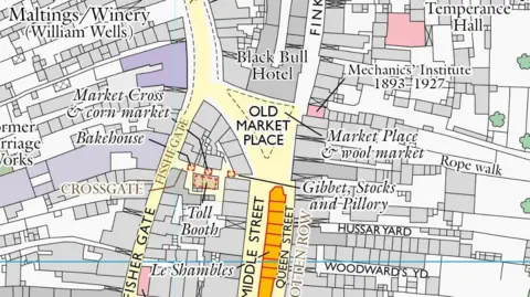
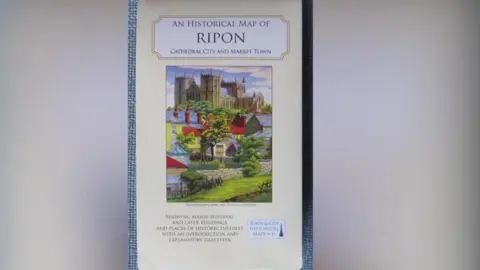
An Historical Map of Ripon, published by the Historic Towns Trust, has been compiled by experts specialising in history, architecture, geology and topography.
The folded map and text reveal the locations of buildings, both lost and surviving, from the Middle Ages to the 20th Century.
Jo Ropner, His Majesty’s Lord-Lieutenant of North Yorkshire, said Ripon was “proud” to have a map dedicated to its rich history.
"Anyone who knows Ripon - or wants to get to know it - will find the new map an invaluable tool for uncovering the city’s fascinating past, because of both the clarity of the mapping and of the authoritative information contained in the gazetteer," she said.
 Historic Towns Trust
Ms Ropner said the map was part of a "growing list" of historical maps of towns and cities across the UK and Ripon was "proud to have" its own one.
As well as pointing out the significant buildings, the map is illustrated with images of the city.
There is also specialist information on Ripon’s fairs and markets, as well as its civic governance, including its famous Hornblower.
Meanwhile, other significant mentions include Ripon being known for making spurs in the 16th and 17th Centuries.
There's also a mention of the first horserace for female jockeys being held at the course on Ripon Common in 1723.
The important role of Ripon Cathedral, formerly Ripon Minster, is also highlighted.
Listen to highlights from North Yorkshire on BBC Sounds, catch up with the latest episode of Look North or tell us a story you think we should be covering here.
