Bomb survey to close town road for five days
 Google
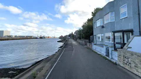
A section of road is expected to be closed from today for a bomb survey to be carried out.
Norfolk County Council said Riverside Road in Gorleston would be closed until Friday, with a diversion in place.
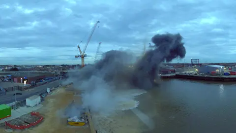
The town, along with nearby Great Yarmouth, was heavily bombed during World War Two, and in February 2023, a bomb discovered about 1,640ft (500m) away from the planned road closure unexpectedly detonated during attempts to defuse it.
The bomb survey is part of preparatory work for a new retaining wall, which will protect the road from erosion and flood risk.
 Sky Revolutions
A council statement said: "The survey will be carried out by Brimstone, a government-approved contractor, who will be on-site from 08:00 GMT to 16:00 throughout the week.
"If any explosives are found, appropriate safety measures will be implemented. Local businesses and residents will be kept informed.
"Although the likelihood of finding anything is very low, Norfolk County Council will ensure the utmost care and diligence whilst conducting this operation."
Parts of Norfolk were heavily bombed during WW2 and it was thought hundreds of unexplored devices remained lying on the seabed off the coast.
The council said Riverside Road would be closed 980ft (300m) south from the junction with Ferry Hill, and construction work on the 490-ft (150-m) sea wall was expected to begin next year.
Follow Norfolk news on BBC Sounds, Facebook, Instagram and X.
