Tornadoes and waterspouts: Europe's underestimated extreme weather threat?
 Getty Images
Spinning over land and water, these terrifying phenomena are more common than we might think.
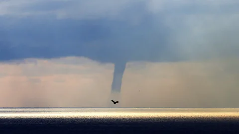
It's the stuff of sailors' nightmares: a giant, spinning column of air and mist against a stormy sky, threatening to hit or even capsize their boat.
Known as a waterspout – a type of tornado – this extreme weather phenomenon has made global headlines this week, as it is thought to have caused the sinking of the Bayesian, a luxury yacht carrying British tech tycoon Mike Lynch and others, off the coast of Sicily. But while these storms may sound like a freak occurrence, both waterspouts and tornadoes on land are more common in Europe than we may think, experts say.
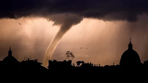
"Waterspouts are essentially tornadoes that occur over water. And a tornado is a rotating column of air extending from a storm cloud," says Pieter Groenemeijer, the director of the European Severe Storms Laboratory, an organisation that aims to help Europe prepare for severe storms through scientific research, communication and better forecasting.
In Europe, there are around 300 tornadoes on land a year, and 500 waterspouts, he says, based on data from the European severe weather database. This is far fewer than in the US, where there are around 1,000 tornadoes a year, but it's still a threat needs to be better understood and prepared for, he says, especially as violent tornadoes do cause damage and loss of life in Europe, too. In 2021, a deadly tornado swept through villages in the Czech Republic, killing several people and injuring more than 150. The regional governor described it as "living hell".
However, experts, including Groenemeijer, have warned that Europe has been underestimating the risks posed by tornadoes and waterspouts. One possible reason, he says, is partly because its countries' weather services operate independently and aren't necessarily routinely sharing weather data with each other.
"If you were to consider all of Europe as one contiguous area, you would see that tornadoes aren't that rare," he says. "But each of these weather services are in one particular county, and of course within each small area you won't see tornadoes that often. That's what we mean by, 'it's an underestimated threat' – each weather service will only see a tornado happening very infrequently and at that moment they’ll probably be very surprised by this event, and think, 'it's hard to prepare for it and issue warnings for it'. It's not seen as enough of a risk."
For example, an analysis of the Czech disaster concluded that "eyewitness reports collected after the tornado show that many people were not aware of the risk associated with the tornado. Eventually, most people tried to shelter in the most secure part of the house, but it was often too late".
 Getty Images
Waterspouts may seem less immediately threatening to people on land – but they can be terrifying as they race towards ports and coastlines, can capsize boats and do not always stay on the water. An analysis of tornadoes and waterspouts recorded in Italy in 2001-2016 found there were 707 waterspouts and 371 tornadoes, with 25% of the waterspouts making landfall and becoming tornadoes.
Waterspouts typically occur during relatively weak storms, Groenemeijer says. "We even call them fair-weather tornadoes," he says. "They occur very frequently in calm situations near coastlines, where you often have the interaction of winds from one particular direction from land and another direction from the sea, so you can get winds from different directions in close proximity to each other. And there is a turning motion where these winds meet."
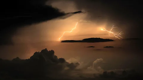
On the other hand, "very strong tornadoes tend to develop with very strong thunderstorms that rotate", adds Groenemeijer. "We call them supercells – big thunderstorms with rotating updraughts." (Read more about the scientists who chase twisters to unlock the secrets of destructive storms.)
In the case of the yacht disaster in Sicily, where the storm appears to have been very powerful, it's not clear whether the column observed over the sea was a waterspout or a downburst, which he describes as "a lot of air coming from the storm and meeting the Earth's surface, and spreading out and producing very strong wind". On land, experts can inspect the shape of the damage path after a storm to evaluate what exact type it was. But that's not possible on the water, where storms may leave no record of damage other than broken boats and such, which is not enough to paint a clear picture of the event, he explains.
In recent years, contributions by storm spotters have helped produce a clearer picture of when and where these phenomena are most likely to occur. An analysis of tornadoes and waterspouts reported between 2000 and 2019 in Catalonia, on the Iberian Peninsula, found the southern European region to be a hotspot of tornadoes and waterspouts, with 105 tornadoes and 329 waterspouts reported in a 32,000 sq km (12,355 sq miles) area – one of the highest densities in the Mediterranean basin.
Images of waterspouts taken by people with mobile phones and shared on social media have been vital in documenting these storms better, says Oriol Rodriguez at the University of Barcelona, one of the Catalonia study's authors. While big, strong tornadoes "can be detected using operational meteorological radars, most weak tornadoes and waterspouts are not observable using this technology", as they are small, he says. "Therefore, the main information sources are direct witnesses. It is fantastic that people can contribute to enhancing the detection of this phenomenon, helping scientists to perform new studies."
An analysis of 234 waterspouts recorded in the Balearic Islands in Spain between 1989 and 2020 found that the majority happened in the autumn months, with the highest frequency seen in September. Analysing their relationship with the sea surface temperature, the study's authors revealed "a higher frequency of waterspouts with higher temperature values, particularly between 23C and 26C (73F and 79F)". The Italian study also found that waterspouts mostly develop in the autumn.
 Getty Images
Understanding how climate change is affecting waterspouts and tornadoes is another challenge, says Groenemeijer.
Overall, climate change is leading to more severe storms in Europe. "There's more energy available for very powerful storms – this is tied to the higher evaporation rate that occurs with higher temperature," says Groenemeijer. Warmer air can contain more water vapour, which condenses in a cloud and turns into drops of water or ice crystals, and as it does so, releases heat which then drives thunderstorms. "So if you have more water vapour in the air, storms get more powerful," Groenemeijer adds. "This is what we see happening across south-central Europe and especially around northern Italy", where warm air from the Mediterranean meets the Alps.
For tornadoes and waterspouts, the impact of climate change may be somewhat different and is still not fully understood, he says. For example, the storm season in the Mediterranean appears to be lengthening, with more storms in August, ahead of the traditionally stormy months of September and October, Groenemeijer says.
Typically, warm and dry air from the Sahara Desert covers much of the Mediterranean Sea, forming a kind of lid that doesn't allow the air directly above the sea water to rise. However, "as the sea surface temperature increases, you can more easily get a situation where the humid, hot air from below breaks through this lid of air originating from the Sahara desert", resulting in a storm, says Groenemeijer. "So warmer sea surface temperatures can lead to more storms earlier in the season."
In summer 2022, a record-breaking marine heat wave over the Mediterranean Sea had a crucial role in triggering a destructive derecho, a long-lived, severe type of storm. Sea surface temperatures soared to locally unprecedented values of up to 4.6°C (8.3°F) more than the average for that season. Since then, the world's oceans have continued to break heat records.
Amid growing global efforts to cope with extreme weather, the European Severe Storms Laboratory has launched a campaign called Tim that aims to improve our understanding of severe storms, especially near mountain ranges. The campaign will connect data from weather services in different European countries and gather additional data with mobile radars, weather balloons and sensors. This will ultimately help forecast these storms more accurately, Groenemeijer says – and prepare for them.
--
For essential climate news and hopeful developments to your inbox, sign up to the Future Earth newsletter, while The Essential List delivers a handpicked selection of features and insights twice a week.
