The quest to predict – and stop – the spread of wildfires
 Josh Edelson/AFP/Getty Images
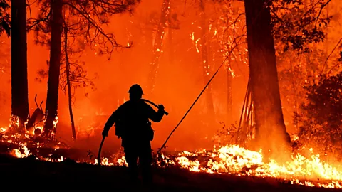
Previous attempts to forecast the spread of fire have been crude and inaccurate – but new experiments promise huge improvements.
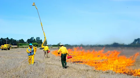
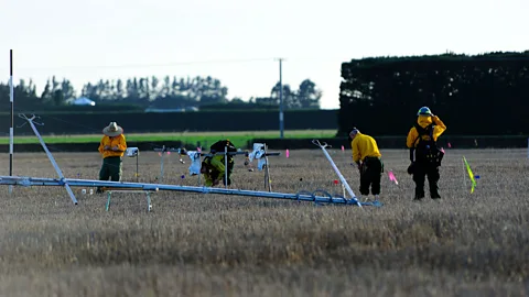
Mark Finney at the US Forest Service and his colleagues sometimes do the unthinkable. They go out into the bush and start a fire. But they’re not arsonists and these fires aren’t sprawling or highly destructive. They’re controlled burns of real vegetation that give scientists a better understanding of how flames leap from one branch to another. Studying that can help predict how real wildfires may spread.
Among the measurements Finney and his team take include the amount of time that flames spend burning in one area, how quickly they propagate through vegetation and what kind of heat exchange is going on as they do so. These experiments have taken place in New Zealand. The burn areas are cordoned off by barriers that stop the fire getting out of control.
“We have drones that fly over and give us a view of what’s going on from the air, we have cameras that are protected by an aluminium and insulation housing that allow you to put them inside the fire,” he says. “It usually takes a day or more to set up all the instruments and of course you have to have the weather conditions cooperating.”
It’s all part of a modern human quest – to know what makes fire tick. A supposedly crucial moment in the history of human evolution is the “discovery” of fire. But fire has been a natural occurrence on Earth since long before our ancestors took their first steps. And today, far from being something under our control, fire often takes the form of a man-made disaster. In the US, well over 80% of wildfires are started, usually accidentally, by people.
If you like this:
This year, like last year, many parts of the planet have experienced very hot and dry summers, sharply raising the chance of wildfires taking hold once ignited.
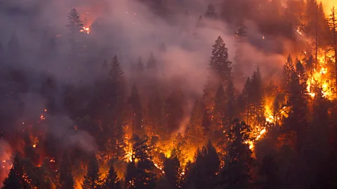
Woodlands have blazed in Greece, Sweden, and Siberia among other hotspots. The southwestern US state of California has just recorded its largest wildfire on record.
What if we’d known when and where these fires would start? Or how they would wax and wane? If we had such knowledge, we’d surely be better able to protect the towns and communities that are at risk from destruction.
Finney hopes that data from his experiments will improve the existing models that are used to project wildfire spread. Some of those models are too simplistic, he explains.
 Ian Grob/US Forest Service
“There’s so many things that we can’t use right now in models – like wind variability. The wind is never constant in speed or direction,” he says. “Yet our models are so crude that they require a single input for wind.”
Over time, the accuracy of these tools is definitely improving, however. In July, a review of Australian wildfire models used to predict fire spread was published. It found that there had been a significant increase in the accuracy of such systems in recent years, reducing errors in their predictions by more than 50%.
What about predicting fires even before they have started? While pinpoint projections of wildfire occurrence are not possible, science is giving us new and better ways of calculating fire risk – and it is helping us understand how major fires may grow once they’ve begun.
Max Joseph is a man who knows that there are secrets in data. He and colleagues at the University of Colorado Boulder’s Earth Lab have pulled together a startling array of insights – from how diseases spread to the effect of climate change on animal populations. But lately, he has turned his attention to fire.
He recently co-authored a study, currently undergoing peer-review, that explored the possibility of predicting which regions in the continental US might be prone to wildfires based on their ecosystems and characteristic weather patterns.
The team gathered weather data going back to 1984, along with information on wildfires that had occurred since then. A computer model analysed the relationship between weather patterns and outbreaks of fire. They found that generally, periods of low humidity – dry air – and high temperature were particularly good indicators of fire risk. More so than rainfall.
 Terray Sylvester/Getty Images
How such conditions affected fires varied greatly from one “ecoregion” to another – areas of differing terrain and vegetation. But by picking up patterns in data spanning 1984-2010, the model proved accurate at predicting fire occurrence in specific regions over the following five years.
“We can predict the number of fires in any one of these regions in a month extremely well,” says Joseph. “99% of the actual numbers were predicted by the model.”
Estimating the size of those fires was more difficult, but the system has given Joseph hope that we can indeed get better at understanding of what areas can expect to see many fires in a certain period, so long as accurate weather data is available in advance.
“I think if we can get some good weather predictions, we may be able to have a pretty darn good idea what will happen next year based on this work,” says Joseph.
Dominique Bachelet, a climate scientist at Oregon State University, praises the team’s efforts, though she suggests there may be more subtle ways of analysing another factor assessed by the study: housing density. You might think that the risk of fire is directly proportional to how many humans and houses live in an area – but it also depends on what vegetation is available to burn. Perhaps just a small settlement, in a very fire-prone place with lots of flammable vegetation, could become associated with more frequent combustion.
The range of factors and methods of interpretation when it comes to the statistical analysis of fire are very broad. Take for example a separate study, published in February, which found a relationship between the number of days with more than 2.54mm of rainfall and wildfires in the western US.
This is a slightly different metric to the ones used by Joseph’s group, but it is in tune with their findings – less rainfall does mean less water is available to vaporise and contribute to humidity. Again, the consequential dryness of the air was found to be a driver of fires.
 Robyn Beck/AFP/Getty Images
As the authors noted: “If decreasing trends in summer precipitation continue, the result will likely be a continuing pattern of dry, warm summers that result in increasingly more severe fire seasons.”
Park Williams at Columbia University’s Lamont-Doherty Earth Observatory says the hot summer was a giveaway that this year would bring significant fires to California.
“It was record-breaking hot this summer across a lot of California,” he explains. “When you get those temperatures you’re likely to have some really big fires.”
Locating hot spots
For the people directly affected by wildfires, what really matters is knowing ahead of time whether the area in which they live will be threatened. The unpredictability of the weather is one complicating factor. But fuel – the vegetation available to burn – is also difficult to quantify. How dense, exactly, is that patch of forest? How dry are the fallen branches this summer? There are efforts to better track this, of course, but many are a work in progress.
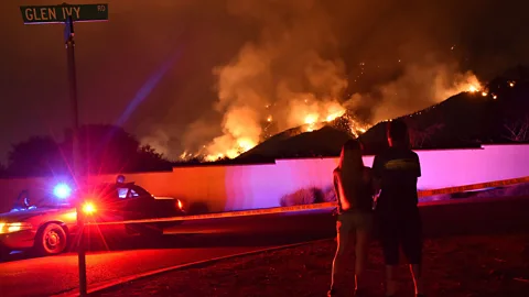
Most of all, given that humans and lightning account for almost all wildfire ignitions, it’s extremely difficult if not impossible to predict exactly when and where a blaze will start. But that doesn’t mean we can’t get an idea.
The most accurate weather forecasts we have, a few days in advance, are used by some agencies to create maps of potential fire hotspots in the US.
“Maps are produced every single day and updated based on forecasted weather conditions that are critical to fire conditions,” says Finney.
That can help authorities make evacuations in time, or allow for firefighting resources to be brought to the right places.
 Ian Grob/US Forest Service
Someone with a particularly strong interest in our knowledge about fire spread is Ellie Graeden at RedZone Analytics. Graeden provides wildfire analysis to commercial clients – including insurance companies. The three main factors her system takes into account, she says, are wind, fuel availability and the topography of the land on which a fire is burning.
The insurance companies advised by RedZone may sometimes deploy their own firefighting teams if insured property can feasibly be protected from a blaze. Or, they may work with people who have insurance to help them protect their property. The data is also useful for estimating how much a truly devastating fire might cost an insurance firm – which is important for planning how to make compensation available to customers.
“We make these assessments and run our models during events,” says Graeden. “After the fact, we go back and find out how accurate we were.”
Last year, Graeden says RedZone’s models predicted which homes in Coffey Park, California, would burn in a devastating wildfire there – with more than 90% accuracy. In total, 3,500 properties were destroyed by that fire.
But even these projections can be improved. Graeden says there is a lack of good, quantitative data on how certain types of homes catch fire and burn. We know that asphalt or clay roofs are less likely to burn than wood ones, for example, but accurate data quantifying the difference between these roofs under fire conditions isn’t readily available, says Graeden.
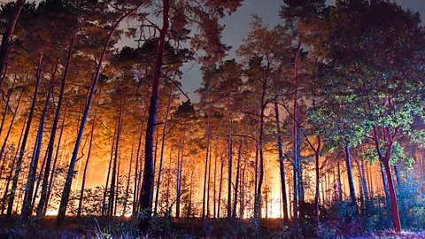
What does the future of wildfire look like? The picture is decidedly mixed. On a global scale, the annual total area burned by wildfires is actually decreasing because of the expansion of farmland. In localised places, though, the hot and dry summers we’re experiencing that are linked to climate change are expected to continue causing problematic fires in places we’d rather not have them – such as right next to urban developments.
 Patrick Pleul/AFP/Getty Images
Bachelet thinks that what we’re observing now is an unusual, transitional period. Dense, woody forests that for centuries experienced much milder summers than we see today are now reacting to that change in climate – by burning.
“What regrows after fire will be more adapted to these conditions so will probably produce less fuel,” says Bachelet. The ecosystems in such areas are “resetting”, she explains.
In places like California, years of fighting fires and leaving trees intact on hillsides allowed forests to become even denser than they might have been. That has exaggerated the effect climate change is now having on those forests, adds Williams.
“The ability of a warming atmosphere to really amplify fires, the table for that was set by there being artificially dense forests,” he says.
Fire is a natural part of these ecosystems, but the incidence and character of recent fires has undoubtedly been shaped by human activity. “People,” says Bachelet, “should expect fire.”
In a warmer world, the inferno seems increasingly capable of threatening our way of life, of bearing down as it so often does, on our towns and our cities. We can’t stop fire in its tracks. Neither will we ever be able to perfectly predict each blaze before it happens. But maybe we can get better at managing fire – and better at getting out of its way.
If you liked this story, sign up for the weekly bbc.com features newsletter, called “If You Only Read 6 Things This Week”. A handpicked selection of stories from BBC Future, Culture, Capital, and Travel, delivered to your inbox every Friday.
