Amber warning issued in West for Storm Darragh
 Ben Birchall/PA Wire
The West Country - along with the rest of England - will be affected by gales or severe gales by late Friday afternoon, overnight and into Saturday, with some disruption likely.
The Met Office has named the incoming bad weather as Storm Darragh. It is the fourth named storm of this autumn and winter.
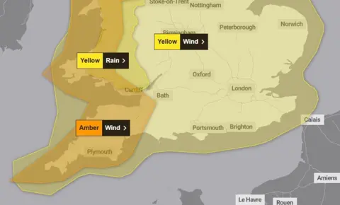
An amber warning for strong winds for western parts of the region is in effect from 03:00GMT to 21:00GMT on Saturday. All of the region is under a yellow warning for strong winds between 15:00GMT on Friday until early Sunday.
Parts of Somerset look at risk of some particularly strong gusts of wind, but the entire West Country will be affected to varying degrees - particularly by the wind and to some extent, by rain.
Strong gusts expected
Strong winds - developing from another low pressure system during Thursday afternoon into the night - are also now subject to a yellow warning from the Met Office. But Storm Darragh will arrive later, during Friday afternoon, bringing strengthening winds initially from the south to south-west.
Through Friday evening into the night and early Saturday, the winds will become more westerly and eventually north-westerly, with the wind strength looking set to peak at this time.
Forecast computer models indicate that parts of Somerset around the Bristol Channel are likely to experience gusts exceeding 50 to 60mph and perhaps even from 70 to 80mph in exposed locations.
 UK Met Office
These sorts of gusts look most probable through parts of west Somerset, east into Bridgwater Bay and across adjacent areas such as the Sedgemoor district and up into north Somerset.
The amber warning issued by the Met Office reflects how these areas are at higher risk of damaging gusts of wind.
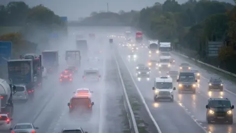
During Friday late evening and into the night, crosswinds on the M5 through Somerset and north Somerset may prove hazardous in some stretches. As the wind turns more north-westerly later on and into early Saturday, the same risk applies to parts of the M4.
Other transport may see disruption, too - and likewise, perhaps power outages in some areas.
Trees at risk
Unlike Storm Bert on 23 and 24 November, which brought widespread flooding, Storm Darragh's threat to the West Country will be more focused on strong winds.
Nonetheless, rain from Darragh has the potential to cause some problems, given existing sensitivities to flooding. Between 15 to 25mm of rain looks likely between Friday to Sunday, with Exmoor likely to see a fair bit more.
It is very likely that Storm Bert has already weakened or damaged some trees or structures, leaving them particularly vulnerable, which may be further exacerbated once the strong winds shift to a north-westerly direction overnight Friday into Saturday.
Trees are frequently exposed to winds from the south-west to west and are more resilient to those. However, unusually strong winds from other less common directions can add extra stress to trees and so increase potential for damage or toppling.
Keep across the Met Office warnings, as revisions are always possible to those already issued for Friday and into the weekend.
Follow BBC Somerset on Facebook and X. Send your story ideas to us on email or via WhatsApp on 0800 313 4630.
